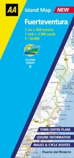
Fuerteventura
2003
Automobile Association (Verlag)
978-0-7495-3781-4 (ISBN)
Automobile Association (Verlag)
978-0-7495-3781-4 (ISBN)
- Titel ist leider vergriffen;
keine Neuauflage - Artikel merken
A detailed, large-scale map showing extensive tourist and leisure information, places of interest, footpaths and hiking trails together with inset plans for the main towns on the island. Useful road information and classifications with distances, cycle routes together with beaches and water sports are featured along with national parks and nature reserves. The map is available in three or more language keys.
| Erscheint lt. Verlag | 15.6.2003 |
|---|---|
| Reihe/Serie | AA Island Maps |
| Verlagsort | Basingstoke |
| Sprache | englisch |
| Maße | 119 x 254 mm |
| Gewicht | 110 g |
| Themenwelt | Reisen ► Karten / Stadtpläne / Atlanten ► Europa |
| Reisen ► Karten / Stadtpläne / Atlanten ► Welt / Arktis / Antarktis | |
| ISBN-10 | 0-7495-3781-7 / 0749537817 |
| ISBN-13 | 978-0-7495-3781-4 / 9780749537814 |
| Zustand | Neuware |
| Haben Sie eine Frage zum Produkt? |
Mehr entdecken
aus dem Bereich
aus dem Bereich
Straßen- und Freizeitkarte 1:250.000
Karte (gefalzt) (2023)
Freytag-Berndt und ARTARIA (Verlag)
CHF 19,90
Karte (gefalzt) (2023)
Freytag-Berndt und ARTARIA (Verlag)
CHF 19,90
Östersund
Karte (gefalzt) (2023)
Freytag-Berndt und ARTARIA (Verlag)
CHF 21,90


