


MARCO POLO Regionalkarte Hauts-de-France, Île-de-France 1:300.000
MAIRDUMONT (Verlag)
978-3-8297-3801-9 (ISBN)
Marco Polo was the original, trailblazing tourist. He was born into a wealthy Venetian merchant family in 1254 and at the age of 17 he embarked on an epic journey to Asia, as one of the first westerners to ever visit China. When he returned 24 years later he recorded his extensive travels in a book - publishing possibly the first travel guide ever - and introducing Europeans to Central Asia and China. Marco Polo's travels have since inspired countless adventurers to set off and see the world. Allegedly, Christopher Columbus set off across the Atlantic with a copy of Marco Polo's original book! It is this pioneering spirit that drives us at Marco Polo Travel Publishing to provide you with the best guides, maps and atlases possible - to inspire you to set off on your own adventures and help you travel the world. We offer a wide range of high quality travel publications to over 200 destinations, all written by local and trusted authors. Pocket Guides Compact, colourful guides packed with Insider Tips and a free Touring App. Spiral Guides Itinerary-based guides in a unique, lay-flat spiral bound format. Travel Handbooks Visually inspiring, comprehensive guides offering detailed advice and informative infographics. Travel Journals Beautifully designed travel journals for use on the road. Phrasebooks Pocket-sized and packed with everyday phrases for confident communication. Folded Maps High quality touring maps with innovative Zoom system. City & Holiday Maps Compact, laminated maps with a detailed scale and maximum coverage. Road Atlases Clear, easy-to-read cartography in a handy spiral bound format. marcopologuides.com
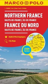
Hauptkarte 1:300 000, Übersichtskarte zum Ausklappen, Verwaltungskarte, Index: mit mehrsprachiger Legende (F, D, GB, NL, I, E, CZ, PL)/ Marco Polo Highlights/ 2 Sonderkarten: - Eurotunnel Calais - Eurotunnel Folkstone 6 Citypläne: - Amiens - Chartres - Lille - Orléans - Paris - Rouen; Marco Polo Highlights/ Verkehrsinformationen/ Reiseinformationen/ Ortsregister mit Départment, Postleitzahl und Suchfeldangabe
| Erscheint lt. Verlag | 3.3.2022 |
|---|---|
| Reihe/Serie | MARCO POLO Karten 1:300.000 |
| Verlagsort | Ostfildern |
| Sprache | englisch; französisch; deutsch |
| Maße | 130 x 251 mm |
| Gewicht | 233 g |
| Themenwelt | Reisen ► Karten / Stadtpläne / Atlanten ► Deutschland |
| Reisen ► Karten / Stadtpläne / Atlanten ► Europa | |
| Schlagworte | Channel Tunnel • Chantilly • Disnyland • Driving • euro tunnel • Fontainebleau • France map • Frankreich • Karte Frankreich • Karte Nordfrankreich • Karte Normandie • Michelin • Nordfrankreich • Normandie • Paris • Perche • Seinetal • Touring • Urlaub Frankreich • Urlaub Normandie |
| ISBN-10 | 3-8297-3801-3 / 3829738013 |
| ISBN-13 | 978-3-8297-3801-9 / 9783829738019 |
| Zustand | Neuware |
| Informationen gemäß Produktsicherheitsverordnung (GPSR) | |
| Haben Sie eine Frage zum Produkt? |
aus dem Bereich


