Road Atlas Ireland
Seiten
2020
Automobile Association (Verlag)
978-0-7495-8230-2 (ISBN)
Automobile Association (Verlag)
978-0-7495-8230-2 (ISBN)
- Titel ist leider vergriffen;
keine Neuauflage - Artikel merken
Zu diesem Artikel existiert eine Nachauflage
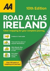
Brand new edition, fully updated.
Clear, easy-to-read scale mapping in A4 atlas format.
Fast reference map grid and Irish grid references.
Detailed road network of the whole of Ireland
This atlas includes AA approved camping sites, viewpoints, picnic sites, port plans and ferry routes. Plus, motorway strip maps detailing all of Ireland's motorway junctions. Toll motorways and motorway service areas are clearly highlighted. There are 10 detailed city and town plans with street indexes of Belfast, Cork, Londonderry, Dublin, Galway, Killarney, Kilkenny, Limerick, Sligo and Waterford. An easy-to-read 3,500 place name index, includes top tourist sites, airports and service areas. Irish language areas are shown on the main mapping with place names in both English and Irish. District maps of Dublin and Belfast show the surrounding area in more detail and a clear route planner map is included for journey planning across the county.
AA Publishing is the UK's largest travel publisher.
| Erscheinungsdatum | 15.01.2021 |
|---|---|
| Verlagsort | Basingstoke |
| Sprache | englisch |
| Maße | 210 x 297 mm |
| Themenwelt | Reisen ► Karten / Stadtpläne / Atlanten ► Europa |
| ISBN-10 | 0-7495-8230-8 / 0749582308 |
| ISBN-13 | 978-0-7495-8230-2 / 9780749582302 |
| Zustand | Neuware |
| Haben Sie eine Frage zum Produkt? |
Mehr entdecken
aus dem Bereich
aus dem Bereich
Buch | Spiralbindung (2024)
Freytag-Berndt und ARTARIA (Verlag)
CHF 41,85


