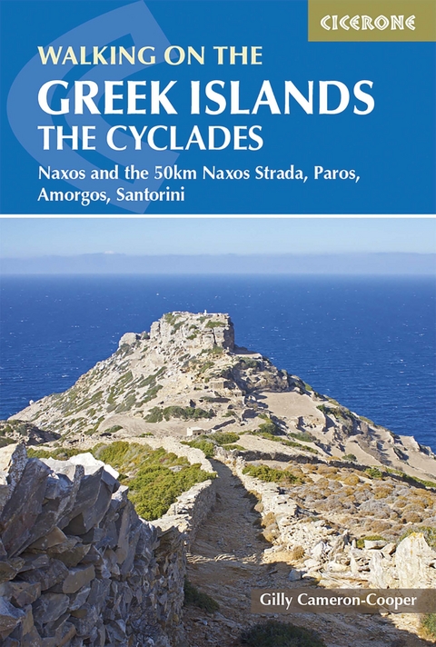
Walking on the Greek Islands - the Cyclades
Cicerone Press (Verlag)
978-1-78631-009-5 (ISBN)
A guidebook to 35 day walks and a 5-day Naxos Strada coast-to-coast route in Greece’s Cycladic islands (Paros, Naxos, Amorgos and Santorini). The islands are linked by ferry, location and history but each offers a distinct walking experience from the peaceful rural monasteries of Paros and rugged mountains of Naxos, to starkly beautiful Amorgos and volcanic Santorini.
Walks range from 4 to 16km (2–10 miles) and can be enjoyed in 2–7 hours. They range from easy to challenging, with optional short-cuts, so there is something for beginner and experienced walkers alike. The Naxos Strada coast-to-coast route is described in 5 stages covering 52km (32 miles).
Anavasi maps are included for each walk
GPX files available to download
Detailed information on accommodation and ferries
Refreshment and public transport options are given for each walk
Insights into Greek wildlife and history
Gilly Cameron-Cooper's main career was as a journalist, non-fiction author and editor, but in 2002 she and her husband Robin set up Walking Plus Ltd, the first company to offer guided and self-guided hiking holidays on the Greek Islands. While living in Athens, Gilly wrote for the English language press and produced consultation documents on sustainable tourism for the Greek government. She has hiked all over the world, publishing articles for national magazines and newspapers, and books on mythology, walking London's waterways, and Beatrix Potter's Lake District.
Map key
Overview map
Introduction
History
Geology
Vegetation and wildflowers
Animal life
Climate
When to go
Travel to the islands
Travel around the islands
Accommodation
Eating and drinking
Shopping and services
What to take
Using this guide
Paros
Walk 1 Parikia town to Cape Fokas
Walk 2 Northwest coast to Kolimbithres
Walk 3 Northwest peninsula eco-park
Walk 4 Naousa port, inland to marble mines
Walk 5 West-coast hills to Parikia
Walk 6 Lefkes village and Byzantine Way
Walk 7 South from Lefkes to Dryos port
Walk 8 Southwest coast: Piso Livadi to Dryos
Walk 9 Angeria mountain circular
Naxos
Walk 10 Naxos town tour
Walk 11 Potamia villages and marble hills
Walk 12 South coast to Demeter's Temple
Walk 13 Rural byways below Profitis Ilias
Walk 14 Wild lands around Apalirou
Walk 15 Central villages and Fanari foothills
Walk 16 Filoti village and Mount Zas
Walk 17 Apiranthos to emery mines and port
Walk 18 Koronos, mountain and east-coast bay
Walk 19 Kynidaros, downriver to Engares
The Naxos Strada
Walk 20 Strada 1: Plaka to Kato Potamia
Walk 21 Strada 2: Kato Potamia to Filoti
Walk 22 Strada 3: Filoti to Apiranthos
Walk 23 Strada 4: Apiranthos to Koronos
Walk 24 Strada 5: Koronos to Apollonas
Amorgos
Walk 25 Egiali and mountain villages
Walk 26 Remote north: monastery and mountains
Walk 27 Along the island spine to Chora
Walk 28 Inland capital to Katapola port
Walk 29 Old routes inland to the capital
Walk 30 Rollercoaster route: Katapola to Vroutsi
Walk 31 Ancient Arkesini and southwest farms
Santorini
Walk 32 Caldera rim: Fira to Ammoudi Bay
Walk 33 Ancient Akrotiri and southwest cape
Walk 34 Villages and vineyards to Emborio
Walk 35 Highest peak and Ancient Thira to Perissa
Appendix A Route summary table
Appendix B Useful Greek words and phrases
Appendix C Bibliography
Appendix D Useful contacts
| Erscheinungsdatum | 18.05.2020 |
|---|---|
| Reihe/Serie | Cicerone guidebooks |
| Zusatzinfo | 35 colour Anavasi maps, 5 colour overview maps, over 90 colour photos |
| Verlagsort | Kendal |
| Sprache | englisch |
| Maße | 116 x 172 mm |
| Gewicht | 280 g |
| Themenwelt | Sachbuch/Ratgeber ► Sport |
| Reisen ► Sport- / Aktivreisen ► Europa | |
| ISBN-10 | 1-78631-009-0 / 1786310090 |
| ISBN-13 | 978-1-78631-009-5 / 9781786310095 |
| Zustand | Neuware |
| Haben Sie eine Frage zum Produkt? |
aus dem Bereich
