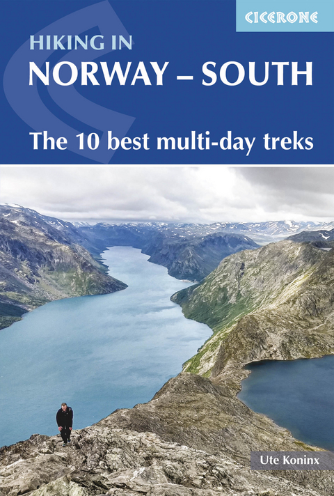
Hiking in Norway - South
Cicerone Press (Verlag)
978-1-85284-975-7 (ISBN)
A guidebook to 10 short treks of 3–8 days in southern Norway. Covering Jotunheimen, Rondane, Dovrefjell, Trollheimen and Ryfylke, the routes showcase the spectacular scenery of Norway’s mountains and fjords.
The treks range from 41 to 152km (25–94 miles), although some can be linked to create longer expeditions. Most stages are graded challenging or very challenging and call for stamina, navigational skill, competence on rough terrain, scrambling ability and – in some instances – a head for heights.
1:200,000 Norwegian Kartverket mapping and elevation profile for each route stage
GPX files available for download
Information on Norway’s excellent network of mountain huts, including hut listings
Local transport details
All the information you need to plan and prepare for your trek
Ute Koninx is a practised world traveller and outdoor enthusiast, and has lived in seven countries on four continents. She developed a love for the Norwegian outdoors whilst living in the country between 2009 and 2015, and has since returned every year for her work as a tour guide as well as further explorations and research.
Preface
Map key
Overview map
Route summary table
Introduction
Norway - a hiker's paradise
Geography and geology
Heritage and outdoor culture
Climate and when to go
Getting to Norway
Getting around Norway
Hiking in Norway
Waymarking and access
Maps and navigation
Accommodation
Equipment
Water, food and supplies
Money
Language
Phones and Wi-Fi
Safety
Emergencies
Using this guide
Jotunheimen
Route 1 Jotunheimen Besseggen route
Route 2 Jotunheimen classic route
Route 3 Jotunheimen traverse route
Rondane
Route 4 Rondane summits
Route 5 Rondane traverse route
Dovrefjell
Route 6 Dovrefjell traverse route
Trollheimen
Route 7 Trollheimen Trekanten triangle route
Route 8 Trollheimen SignaTur route
Route 9 Trollheimen fells to fjord route
Ryfylke
Route 10 Lysefjord circuit
Appendix A Overview of routes and daily stages
Appendix B Table of mountain huts and key services provided
Appendix C Useful websites and transport schedules
Appendix D Norwegian berries
| Erscheinungsdatum | 28.01.2021 |
|---|---|
| Reihe/Serie | Cicerone guidebooks |
| Zusatzinfo | 62 maps, 56 elevation profiles, 3 public transport diagrams and more than 80 colour photos |
| Verlagsort | Kendal |
| Sprache | englisch |
| Maße | 116 x 172 mm |
| Gewicht | 340 g |
| Themenwelt | Sachbuch/Ratgeber ► Sport |
| Reisen ► Sport- / Aktivreisen ► Europa | |
| ISBN-10 | 1-85284-975-4 / 1852849754 |
| ISBN-13 | 978-1-85284-975-7 / 9781852849757 |
| Zustand | Neuware |
| Haben Sie eine Frage zum Produkt? |
aus dem Bereich
