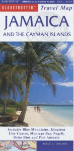
Jamaica and the Cayman Islands
1998
|
First ed.
New Holland Publishers Ltd (Verlag)
978-1-85368-719-8 (ISBN)
New Holland Publishers Ltd (Verlag)
978-1-85368-719-8 (ISBN)
- Titel erscheint in neuer Auflage
- Artikel merken
Zu diesem Artikel existiert eine Nachauflage
Designed for tourists and visitors, this illustrated map pinpoints places of interest and key buildings. Distance and climate charts, and a calendar of events allow travellers to plan their visits. Areas of special interest, including Kingston city centre, are shown in greater detail.
Designed for tourists and visitors, this illustrated map pinpoints places of interest and key buildings. Distance and climate charts, and a calendar of events allow travellers to plan their visits. In addition to the main map of Jamaica, areas of special interest are shown in greater detail. There are town plans of Kingston city centre, Ocho Rios, Port Antonio and Spanish Town. Area maps of the Blue Mountains, Kingston and surrounding area, Negril, Negril to Montego Bay, and Ocho Rios to Port Antonio are provided. The areas of the Cayman Islands shown in greater detail are: Cayamn Brac; Grand Cayman; Little Cayman; and Georgetown.
Designed for tourists and visitors, this illustrated map pinpoints places of interest and key buildings. Distance and climate charts, and a calendar of events allow travellers to plan their visits. In addition to the main map of Jamaica, areas of special interest are shown in greater detail. There are town plans of Kingston city centre, Ocho Rios, Port Antonio and Spanish Town. Area maps of the Blue Mountains, Kingston and surrounding area, Negril, Negril to Montego Bay, and Ocho Rios to Port Antonio are provided. The areas of the Cayman Islands shown in greater detail are: Cayamn Brac; Grand Cayman; Little Cayman; and Georgetown.
| Erscheint lt. Verlag | 1.10.1998 |
|---|---|
| Reihe/Serie | Globetrotter Travel Map |
| Zusatzinfo | 12 colour photographs, charts |
| Verlagsort | London |
| Sprache | englisch |
| Maße | 126 x 251 mm |
| Gewicht | 98 g |
| Themenwelt | Reisen ► Karten / Stadtpläne / Atlanten ► Nord- / Mittelamerika |
| ISBN-10 | 1-85368-719-7 / 1853687197 |
| ISBN-13 | 978-1-85368-719-8 / 9781853687198 |
| Zustand | Neuware |
| Haben Sie eine Frage zum Produkt? |
