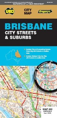
Brisbane City Streets & Suburbs Map 462 8th ed (waterproof)
2018
|
Eighth Edition
UBD Gregory's (Verlag)
978-0-7319-3173-6 (ISBN)
UBD Gregory's (Verlag)
978-0-7319-3173-6 (ISBN)
- Titel erscheint in neuer Auflage
- Artikel merken
Zu diesem Artikel existiert eine Nachauflage
The latest edition of the Brisbane City Streets and Suburbs city map has been fully revised and updated and includes detailed street level mapping and a suburbs and localities index for Brisbane and surrounding suburbs at a scale of 1: 25 000 with coverage north to Zillmere, south to Sunnybank, east to Tingalpa and west to Mount Coot-tha.
There is also suburban mapping and a suburbs index with coverage from Caboolture in the north, Jimboomba & Upper Coomera in the south, along the coast fromBongaree in the north to Jacobs Well in the south and west to Ipswich.
With so much information packed into this handy fold out map this is an essential tool when navigating your way around the Brisbane area.
| Erscheint lt. Verlag | 28.9.2018 |
|---|---|
| Reihe/Serie | City Map |
| Zusatzinfo | Full colour map |
| Sprache | englisch |
| Maße | 690 x 1000 mm |
| Themenwelt | Reisen ► Karten / Stadtpläne / Atlanten |
| ISBN-10 | 0-7319-3173-4 / 0731931734 |
| ISBN-13 | 978-0-7319-3173-6 / 9780731931736 |
| Zustand | Neuware |
| Informationen gemäß Produktsicherheitsverordnung (GPSR) | |
| Haben Sie eine Frage zum Produkt? |
Mehr entdecken
aus dem Bereich
aus dem Bereich
Karte (gerollt) (2023)
Freytag-Berndt und ARTARIA (Verlag)
CHF 39,90
Karte (gerollt) (2023)
Freytag-Berndt und ARTARIA (Verlag)
CHF 31,90
Wander-, Rad- und Freizeitkarte, 7. Auflage
Karte (gefalzt) (2023)
Pietruska (Verlag)
CHF 16,90


