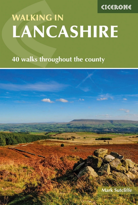
Walking in Lancashire
Cicerone Press (Verlag)
978-1-78631-003-3 (ISBN)
A guidebook to 39 circular day walks and one two-day trek in Lancashire. Exploring the varied scenery of northern England, the walks are suitable for beginner and experienced walkers alike.
Day walks range from 8 to 16km (5–10 miles) and can be enjoyed in 3–5 hours. The Bowland Traverse trek is a longer more challenging walk that takes 2 days and covers 46km (29 miles) between Wennington and Giggleswick across the Bowland Fells.
1:50,000 OS maps included for each walk
GPX files available to download
Detailed information on planning, facilities and public transport
Local points of interest are featured including the Ribble Valley and West Pennine Moors
Easy access from Preston, Burnley and Lancaster
An experienced outdoor writer and editor, Mark Sutcliffe is a former editor of Country Walking and Lakeland Walker magazines. He is an occasional contributor to some of the UK's leading outdoor magazines including Countryfile, Landscape and Trail. Mark has in-depth knowledge of the Forest of Bowland, where he spends much of his spare time hiking, bird watching and taking pictures. In 2016 he completed the Yorkshire Three Peaks Challenge, raising funds for dementia research.
Contents
Introduction
History
Landscape and geology
Wildlife
How to get there
Getting around
Bases
Food and drink
When to go
Access land
Footpaths
Safety
Before setting out
In an emergency
Maps
Using this guide
North Lancashire and the Bowland Fells
Walk 1 Beacon Fell and Brock Valley
Walk 2 Bleasdale Ridge circular
Walk 3 Clougha Pike
Walk 4 Cross o' Greet and Bowland Knotts
Walk 5 Grizedale and Nicky Nook
Walk 6 Langden and Hareden Valleys
Walk 7 Parlick Pike and Fair Snape
Walk 8 Roeburndale - the enchanted valley
Walk 9 Stocks Reservoir circular
Walk 10 Tarnbrook and the Ward's Stone
Walk 11 The Upper Wyre Way
Walk 12 Whin Fell and the Brennand Valley
Walk 13 Whitendale Hanging Stones
Walk 14 Whitewell and the Upper Hodder Valley
Walk 15 Glasson, Cockersand Abbey and Conder Green
Walk 16 Gragareth - Lancashire's county top
Walk 17 Kirkby Lonsdale and Whittington
Walk 18 Sunderland Point
Walk 19 Silverdale and Warton Crag
Walk 20 Easington Fell and Beacon Hill from Grindleton
Walk 21 The Bowland Traverse
West Lancashire
Walk 22 Hurst Green and Ribchester
Walk 23 Longridge Fell
Walk 24 Jeffrey Hill
Walk 25 Great Eccleston and St Michael's on Wyre
Walk 26 Rufford and Mere Sands Wood
South Lancashire and the West Pennine Moors
Walk 27 Barrowford and Foulridge
Walk 28 Holcombe Moor from Ramsbottom
Walk 29 Great Hameldon Hill from Accrington
Walk 30 Anglezarke and Great Hill
Walk 31 Belmont and Great Hill
Walk 32 Sunnyhurst Wood and Darwen's Jubilee Tower
Walk 33 The foothills of Pendle from Downham
Walk 34 Pendle Hill from Pendleton
Walk 35 Pendle Hill and the Clarion House
Walk 36 Pleasington and Billinge
Walk 37 Weets Hill from Barnoldswick
Walk 38 Whalley Nab
Walk 39 The reservoirs of Worsthorne Moor
Walk 40 Wycoller and Boulsworth Hill
Appendix A Route summary table
Appendix B Useful contacts
| Erscheinungsdatum | 02.07.2021 |
|---|---|
| Reihe/Serie | Cicerone guidebooks |
| Verlagsort | Kendal |
| Sprache | englisch |
| Maße | 116 x 172 mm |
| Gewicht | 210 g |
| Themenwelt | Sachbuch/Ratgeber ► Sport |
| Reisen ► Sport- / Aktivreisen ► Europa | |
| ISBN-10 | 1-78631-003-1 / 1786310031 |
| ISBN-13 | 978-1-78631-003-3 / 9781786310033 |
| Zustand | Neuware |
| Informationen gemäß Produktsicherheitsverordnung (GPSR) | |
| Haben Sie eine Frage zum Produkt? |
aus dem Bereich
