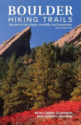
Boulder Hiking Trails, 5th Edition
Graphic Arts Books (Verlag)
978-1-5132-6214-7 (ISBN)
- Titel nicht im Sortiment
- Artikel merken
Long-time Boulder residents Ruth Carol and Glenn Cushman lead you on their favorite and most scenic hikes through mountains, plains, and foothills, just a few minutes’ drive from Boulder. Walk in Chautauqua Park and view the Flatirons, explore Mount Sanitas, marvel at the Royal Arch, embrace nature in Eldorado Canyon State Park, find historical sites and beautiful lakes and waterfalls, and more. Boulder Hiking Trails features:
A total of 84 trails, loops, and hikes, with 6 brand-new trails
New color photographs along with updated maps
Trail descriptions of each hike, including the highlights, distance, elevation, and difficulty
Optional connecting trails for hikers who want more
Historical tidbits and fun facts of the trails’ locales
Directions and access to the trail
This guide is great for hikers of all levels to discover the best hikes found in Boulder, Colorado.
Ruth Carol Cushman is a retired reference librarian and the coauthor of Boulder County Nature Almanac, Colorado Nature Almanac, Wild Boulder County, The Shortgrass Prairie, and the Peterson Field Guide to the North American Prairie. She is an avid hiker and lives in Boulder, CO. Glenn Cushman is a retired aerospace engineer and an active hiker and devoted naturalist. He lives in Boulder, CO.
Preface
Acknowledgments
A Brief History of Hiking, Parks, and Open Space in the Boulder Area
Best of the Best for...
Mindfulness: Know Before You Go
PLAINS
St. Vrain Greenways Trail
McIntosh Lake Loop
Pella Crossing: Braly Trail, Marlatt Trail
Lagerman Reservoir Loop
Coot Lake to Boulder Reservoir
Boulder Valley Ranch: Eagle and Cobalt Trails
East Boulder Trail: White Rocks and Gunbarrel Hill, Teller Lakes
Walden and Sawhill Ponds
Legion Loop Trail
Boulder Creek Path
South Boulder Creek Trail: Baseline Road to Marshall Road
Davidson Mesa Loops
Carolyn Holmberg Preserve/Rock Creek Farm: Cradleboard Trail
Coal Creek Trail
Marshall Mesa and Community Ditch: Coal Seam Trail and Community Ditch to Doudy Draw, Marshall Valley and Community Ditch Loop, Marshall Mesa to Greenbelt Plateau
FOOTHILLS
Button Rock Preserve Loop via Sleepy Lion Trail
Rabbit Mountain: Little Thompson Overlook Trail
Hall Ranch: Bitterbrush Trail and Nelson Loop
Heil Ranch: Lichen Loop, Wapiti Trail, Ponderosa Loop
Bald Mountain Scenic Area: Pines-to-Peak Trail
Sugarloaf Mountain Trail
Interim Joder Trail
Foothills Trail
Anne U. White Trail
Betasso Preserve: Canyon Loop Trail
Forsythe Canyon Creek Trail to Gross Reservoir
Mount Sanitas Loop
Red Rocks and Anemone Hill Loop
Flagstaff Trail
Range View Trail to Artists Point
Gregory Canyon Trail
Saddle Rock and Amphitheater Loop
Green Mountain Loop via E. M. Greenman and Ranger Trails
Bluebell-Baird Trail
Royal Arch Trail
Mesa Trail
McClintock and Enchanted Mesa Loop
Walter Orr Roberts Nature Trail
Mallory Cave Trail
Bear Peak Loop via Bear Canyon, Bear Peak West Ridge, and Fern Canyon
Big Bluestem and South Boulder Creek West Loop
South Boulder Peak via Shadow Canyon
Towhee and Homestead Loop
Flatirons Vista North Trail to Doudy Draw
Fowler, Goshawk Ridge, and Spring Brook Loop
Walker Ranch Loop
Meyers Homestead Trail
MOUNTAINS
Easy and Moderate Mountain Trail Segments
Wild Basin Area
Ouzel Lake via Calypso Cascade and Ouzel Falls
St. Vrain Area
Buchanan Trail
Gibraltar Lake and St. Vrain Glaciers Trail
Red Deer Lake Trail
Buchanan Pass and Sawtooth Mountain Trails
St. Vrain Mountain Trail
South St. Vrain Trail to Brainard Lake
Ceran St. Vrain Trail to Miller Rock
Brainard Lake Area
Mount Audubon Trail
Blue Lake via Mitchell Lake Trail
Pawnee Pass via Long Lake and Lake Isabelle
Sourdough Trail
Caribou and Rainbow Lakes Area
Caribou Town Site and Caribou Hill
Caribou Ranch: DeLonde Trail, Blue Bird Loop
Rainbow Lakes Trail
Arapaho Glacier Trail to Arapaho Glacier Overlook
Arapaho Pass Area
Arapaho Pass Trail: Arapaho Pass, Diamond Lake, South Arapaho Peak
Hessie Area
Devils Thumb Bypass Trail to Jasper Lake, Devils Thumb Lake, and Devils Thumb Pass
King Lake Trail to King, Betty, and Bob Lakes
Woodland Lake and Skyscraper Reservoir Trails
Rollins Pass Area
Forest Lakes Trail from Rollins Pass Road
James Peak via Rogers Pass Trail
NEARBY STATE AND COUNTY PARKS
Eldorado Canyon State Park: Rattlesnake Gulch Trail
White Ranch County Park: Rawhide Loop
Golden Gate Canyon State Park: Horseshoe and Mule Deer Trails to Frazer Meadow
St. Vrain State Park: Pelican Pond Loop
Barr Lake State Park: Gazebo Trail
Appendices
Wheelchair-Accessible Trails
Bibliography
Index
| Erscheinungsdatum | 26.10.2018 |
|---|---|
| Zusatzinfo | 112 color photographs and 64 maps |
| Verlagsort | Portland |
| Sprache | englisch |
| Maße | 139 x 215 mm |
| Gewicht | 385 g |
| Themenwelt | Sachbuch/Ratgeber ► Sport |
| Reiseführer ► Nord- / Mittelamerika ► USA | |
| ISBN-10 | 1-5132-6214-9 / 1513262149 |
| ISBN-13 | 978-1-5132-6214-7 / 9781513262147 |
| Zustand | Neuware |
| Haben Sie eine Frage zum Produkt? |
aus dem Bereich


