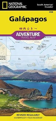
Galapagos
Adventure Map
Seiten
2018
National Geographic Maps (Verlag)
978-1-56695-787-8 (ISBN)
National Geographic Maps (Verlag)
978-1-56695-787-8 (ISBN)
- Titel z.Zt. nicht lieferbar
- Portofrei ab CHF 40
- Auch auf Rechnung
- Artikel merken
Waterproof, Tear-Resistant Travel Map. Resting on the Nazca tectonic plate in the eastern Pacific Ocean approximately 600 miles west of Ecuador, the actively volcanic Galapagos Islands were discovered in 1535 by the bishop of Panama, Toms de Berlanga, when his ship drifted off course. In 1835, naturalist Charles Darwin, aboard the H.M.S Beagle, arrived in the Galapagos and spent 5 weeks collecting geological and biological specimens from several islands, noting his surprise at the variety of birds, tortoises, iguanas and other creatures - all without fear of humans. Darwin's short visit inspired, in part, his 1859 theory of evolution by natural selection and led to the declaration of Galapagos as a national park 100 years later in 1959. Galapagos was declared the first UNESCO World Heritage site in 1978. Now, National Geographic has created a map of this island chain that is so remote that many of the species who live here can be found nowhere else on earth. The front of the map incl
| Erscheint lt. Verlag | 27.12.2018 |
|---|---|
| Zusatzinfo | 1 Illustrations, unspecified |
| Verlagsort | Evergreen |
| Sprache | englisch |
| Maße | 108 x 235 mm |
| Themenwelt | Reisen ► Karten / Stadtpläne / Atlanten |
| ISBN-10 | 1-56695-787-7 / 1566957877 |
| ISBN-13 | 978-1-56695-787-8 / 9781566957878 |
| Zustand | Neuware |
| Haben Sie eine Frage zum Produkt? |
Mehr entdecken
aus dem Bereich
aus dem Bereich
Karte/Kartografie (2024)
BVA BikeMedia (Verlag)
CHF 25,90
Karte (gefalzt) (2023)
Freytag-Berndt und ARTARIA (Verlag)
CHF 21,90
Karte (gerollt) (2023)
Freytag-Berndt und ARTARIA (Verlag)
CHF 39,90


