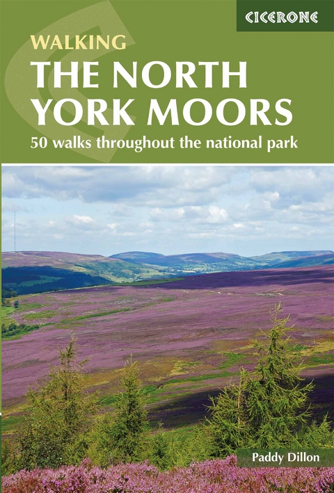
The North York Moors
Cicerone Press (Verlag)
978-1-85284-951-1 (ISBN)
A guidebook to 50 walks in the North York Moors, the largest continuous expanse of heather moorland in England. Routes range from short and easy low-level walks to long and strenuous routes across the high moors, including the Lyke Wake Walk – a 4-stage, 65km (40 mile) route traversing the national park from west to east.
The walks range in length from 7–22km (4–14 miles) and can be enjoyed in between 2 and 7 hours. They are arranged by area into the Tabular Hills, Hambleton Hills, Cleveland Hills, Northern Moors, High Moors, Eastern Moors and Cleveland Coast.
1:50,000 OS maps included for each walk
Sized to easily fit in a jacket pocket
GPX files available to download
Detailed information on terrain, refreshments and public transport for each walk
Information given on local history and archaeology
Paddy Dillon is a prolific outdoor writer with over 90 guidebooks to his name, and contributions to 40 other publications. He has written for a variety of outdoor magazines, as well as many booklets and brochures for tourism organisations. Paddy lives near the Lake District and has walked in every county in England, Scotland, Ireland and Wales; writing about walks in every one of them. He enjoys simple day walks, challenging long-distance walks, and is a dedicated island-hopper. He has led guided walks and walked extensively in Europe, as well as in Nepal, Tibet, Korea, Africa and the Rocky Mountains of Canada and the United States.
Map key
Overview map
Introduction
Brief history of the moors
North York Moors industries
Getting to the North York Moors
Getting around the North York Moors
Accommodation
Food and drink
When to walk
Maps of the routes
National park visitor centres
Tourist information centres
Emergency services
Using this guide
The Tabular Hills
Walk 1 West Ayton, Hackness and the Forge Valley
Walk 2 Hackness, Broxa and Whisper Dales
Walk 3 Lockton, Stain Dale, Saltergate and Levisham Moor
Walk 4 Levisham and the Hole of Horcum
Walk 5 Levisham Station, Levisham and Newton-on-Rawcliffe
Walk 6 Hutton-le-Hole, Lastingham, Cropton and Appleton-le-Moors
Walk 7 Gillamoor, Boonhill Common and Fadmoor
Walk 8 Newgate Bank, Rievaulx Moor and Helmsley Bank
Walk 9 Helmsley, Beck Dale and Ash Dale
Walk 10 Hawnby Hill and Easterside Hill
The Hambleton Hills
Walk 11 Rievaulx Abbey and Old Byland
Walk 12 Byland Abbey, Mount Snever and Oldstead
Walk 13 Sutton Bank, Gormire Lake and the White Horse
Walk 14 Osmotherley, Thimbleby, Siltons and Black Hambleton
The Cleveland Hills
Walk 15 Osmotherley, Beacon Hill and High Lane
Walk 16 Chop Gate, Cringle Moor and Cock Howe
Walk 17 Chop Gate, Urra Moor, Hasty Bank and Cold Moor
Walk 18 Kildale, Ingleby Moor and Battersby Moor
Walk 19 Kildale, Leven Vale, Baysdale and Hograh Moor
The Northern Moors
Walk 20 Great Ayton, Easby Moor and Roseberry Topping
Walk 21 Guisborough, Gisborough Moor and Hutton Village
Walk 22 Danby, Siss Cross, Commondale and Castleton
Walk 23 Scaling Dam, Clitherbeck, Danby and Beacon Hill
The High Moors
Walk 24 Chop Gate, Cock Howe, Ryedale and Wetherhouse Moor
Walk 25 Chop Gate, Tripsdale, Bransdale and Bilsdale
Walk 26 Low Mill, Harland, Rudland Rigg and West Gill
Walk 27 Church Houses, Bloworth Crossing and Farndale Moor
Walk 28 Hutton-le-Hole, Ana Cross, Spaunton Moor and Lastingham
Walk 29 Rosedale Abbey, Hartoft, Lastingham and Ana Cross
Walk 30 Rosedale Ironstone Railway around Rosedale Head
Walk 31 Rosedale Ironstone Railway from Blakey to Battersby
Walk 32 Westerdale, Fat Betty, Westerdale Moor and Esklets
Walk 33 Danby, Castleton, Botton Village and Danby Rigg
Walk 34 Lealholm, Heads, Glaisdale Moor and Glaisdale Rigg
Walk 35 Glaisdale Rigg, Egton High Moor and Egton Bridge
The Eastern Moors
Walk 36 Goathland, Simon Howe, Wheeldale and Mallyan Spout
Walk 37 Rail Trail from Moorgates to Goathland and Grosmont
Walk 38 Goathland, Sleights Moor and Whinstone Ridge
Walk 39 Goathland, Eller Beck, Lilla Howe and Goathland Moor
Walk 40 Chapel Farm, Lilla Howe and Jugger Howe Beck
Walk 41 Sleights, Ugglebarnby, Falling Foss and Littlebeck
The Cleveland Coast
Walk 42 Runswick Bay, Hinderwell, Staithes and Port Mulgrave
Walk 43 Runswick Bay, Kettleness and Goldsborough
Walk 44 Whitby, Saltwick Bay, Robin Hood's Bay and Hawsker
Walk 45 Robin Hood's Bay, Boggle Hole and Ravenscar
Walk 46 Cloughton, Staintondale, Ravenscar and Hayburn Wyke
The Lyke Wake Walk
Walk 47 Osmotherley, Carlton Bank, Cringle Moor and Hasty Bank
Walk 48 Clay Bank, Urra Moor, Bloworth Crossing and Blakey
Walk 49 Rosedale Head, Hamer, Wheeldale Moor and Simon Howe
Walk 50 Eller Beck, Lilla Howe, Jugger Howe Moor and Ravenscar
Appendix A Route summary table
Appendix B Useful contacts
| Erscheinungsdatum | 15.03.2019 |
|---|---|
| Reihe/Serie | Cicerone guidebooks |
| Verlagsort | Kendal |
| Sprache | englisch |
| Maße | 116 x 172 mm |
| Gewicht | 290 g |
| Themenwelt | Sachbuch/Ratgeber ► Sport |
| Reiseführer ► Europa ► Großbritannien | |
| Reisen ► Sport- / Aktivreisen ► Europa | |
| ISBN-10 | 1-85284-951-7 / 1852849517 |
| ISBN-13 | 978-1-85284-951-1 / 9781852849511 |
| Zustand | Neuware |
| Haben Sie eine Frage zum Produkt? |
aus dem Bereich


