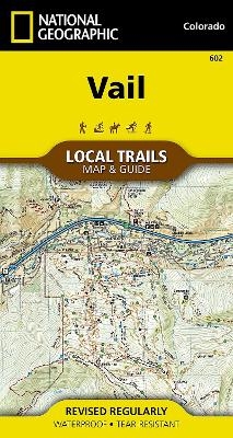
Vail - Local Trails
Seiten
2018
|
2018th ed.
National Geographic Maps (Verlag)
978-1-56695-754-0 (ISBN)
National Geographic Maps (Verlag)
978-1-56695-754-0 (ISBN)
Waterproof, Tear-Resistant Topographic Map. Situated at 8,150 feet in the upper reaches of the Gore Valley and encircled by the White River National Forest, Vail combines one of the world's best alpine ski resorts with a friendly community that maintains its small-town feel. Visitors from around the world can find varied shops and restaurants, luxurious accommodations, bountiful cultural events, and year - round recreational opportunities - from hiking to skiing to biking. With so many outdoor recreation options, visitors to Vail have an enviable problem, where should they start? This map is a combination of a standard trail map on the front with a helpful guide on the back that has a selection of recommended hikes, from the moderate 2.9 mile Berrypicker to the strenuous 3,100 foot climb up to Pitkin Lake. Each selected trail includes a brief description, specs such as elevation gain and length as well as a detailed elevation profile to track your progress up and down the numerous pea
| Erscheint lt. Verlag | 9.4.2018 |
|---|---|
| Verlagsort | Evergreen |
| Sprache | englisch |
| Maße | 495 x 667 mm |
| Themenwelt | Reisen ► Karten / Stadtpläne / Atlanten ► Nord- / Mittelamerika |
| Reiseführer ► Nord- / Mittelamerika ► USA | |
| ISBN-10 | 1-56695-754-0 / 1566957540 |
| ISBN-13 | 978-1-56695-754-0 / 9781566957540 |
| Zustand | Neuware |
| Haben Sie eine Frage zum Produkt? |
Mehr entdecken
aus dem Bereich
aus dem Bereich
Karte (gefalzt) (2024)
Michelin Editions des Voyages (Verlag)
CHF 20,55
Map
Karte (gefalzt) (2024)
Michelin Editions des Voyages (Verlag)
CHF 15,90


