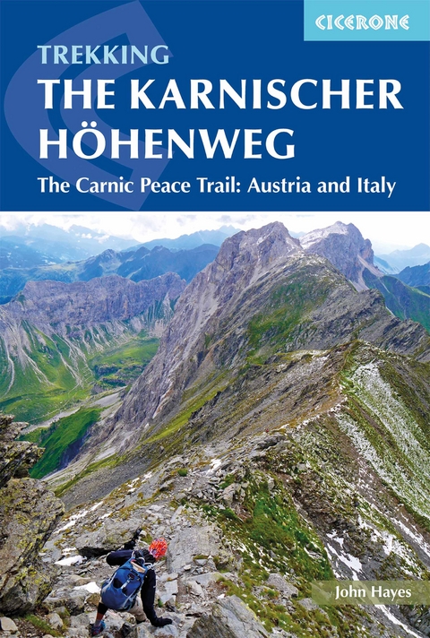
The Karnischer Hohenweg
Cicerone Press (Verlag)
978-1-85284-942-9 (ISBN)
A guidebook to trekking the Karnischer Höhenweg, or Carnic Peace Trail. The 170km hut-to-hut trail follows the World War I front line through the Carnic Alps, along the border of Austria and Italy, and is rich in historical, geological and cultural interest. It can be hiked in 1–2 weeks and is suitable for walkers with a reasonable level of fitness, a sense of adventure and a head for heights.
The guidebook covers both the Austrian variant, which is presented in 8 day stages, and the Italian variant, presented over 10 days, with stages ranging from 6 to 28km. Also included are optional detours to climb neighbouring peaks, such as Monte Coglians.
1:50,000 mapping and elevation profile provided for each stage
GPX files available to download
Handy route summary tables help you plan your itinerary
Accommodation listings included
Advice on planning and preparation
John Hayes is a retired management consultant with degrees from Liverpool University and University College London. Immediately after finishing work in 2011 he embarked on an epic 5,000km trek across Europe, walking from Tarifa in Spain to Budapest. The veteran of numerous long treks in the Alps, Spain and the Himalayas, John has written for numerous walking and trekking magazines.
Map key
Area map
Route overview map
Route summary tables
Introduction
The Peace Trail
The route
World War I earthworks and remains
The landscape and views
Geology
Plants and wildlife
How hard is the walk?
Selecting an itinerary
Getting to and from the route
When to go
Accommodation and food
Budget
What to take
Routefinding
Safety and emergencies
Using this guide
The route
Stage 1 Arnbach to Obstanserseehütte
Stage 2 Obstanserseehütte to Porzehütte
Stage 3 Porzehütte to Hochweißsteinhaus
Stage 4 Austrian route: Hochweißsteinhaus to Gasthof Valentinalm
Stage 4A Italian route: Hochweißsteinhaus to Rifugio Marinelli
Stage 5 Austrian route: Gasthof Valentinalm to Zollnerseehütte
Stage 5A Italian route: Rifugio Marinelli to Plöckenpass
Stage 5B Italian route: Plöckenpass to Casera Pramosio
Stage 5C Italian route: Casera Pramosio to Zollnerseehütte
Stage 6 Zollnerseehütte to Nassfeld
Stage 7 Nassfeld to Gasthaus Starhand
Stage 8 Gasthaus Starhand to Arnoldstein
Appendix A Route breakdown
Appendix B Accommodation
Appendix C Useful contacts
| Erscheinungsdatum | 05.07.2018 |
|---|---|
| Reihe/Serie | Cicerone guidebooks |
| Zusatzinfo | 14 maps and over 50 photographs |
| Verlagsort | Kendal |
| Sprache | englisch |
| Maße | 116 x 172 mm |
| Gewicht | 200 g |
| Themenwelt | Sachbuch/Ratgeber ► Sport |
| Reiseführer ► Europa ► Italien | |
| Reiseführer ► Europa ► Österreich | |
| Reisen ► Sport- / Aktivreisen ► Europa | |
| ISBN-10 | 1-85284-942-8 / 1852849428 |
| ISBN-13 | 978-1-85284-942-9 / 9781852849429 |
| Zustand | Neuware |
| Informationen gemäß Produktsicherheitsverordnung (GPSR) | |
| Haben Sie eine Frage zum Produkt? |
aus dem Bereich


