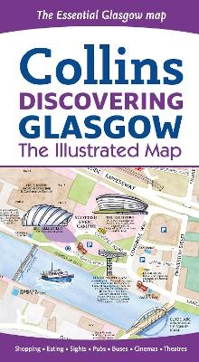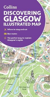
Discovering Glasgow Illustrated Map
Ideal for Exploring
Seiten
2018
|
2nd Revised edition
Collins (Verlag)
978-0-00-826691-2 (ISBN)
Collins (Verlag)
978-0-00-826691-2 (ISBN)
- Titel erscheint in neuer Auflage
- Artikel merken
Zu diesem Artikel existiert eine Nachauflage
Explore new places with dependable maps from Collins.
Glasgow, the largest city in Scotland, is on the itinerary of many visitors to the country. This updated map displays delightful watercolour mapping, with individual paintings of all the main sights and landmarks in the city.
Covers the centre of Glasgow from the Botanic Gardens in the north and the new Riverside Museum to the west to the 12th century Cathedral and the gritty Barras Market to the east.
Further mapping stretches southwest to Pollok Park and the Burrell Collection.
The map features:
• Historical and contemporary anecdotes
• Popular areas at larger scale, hundreds of shops, restaurants, cafés and bars
• Comprehensive travel information and index
• Shop by shop street maps of Buchanan Street and the Merchant City
• Railway stations, bus routes, taxi ranks and car parks
Dominic Beddow produces informative maps of cities from Amsterdam to Zanzibar. The hand illustrated Collins maps include London, Glasgow and Edinburgh. The maps are checked on foot, bicycle or scooter and then peppered with useful description, whimsy, humour and historical anecdote.
| Erscheint lt. Verlag | 8.2.2018 |
|---|---|
| Verlagsort | London |
| Sprache | englisch |
| Maße | 113 x 205 mm |
| Gewicht | 60 g |
| Themenwelt | Reisen ► Karten / Stadtpläne / Atlanten ► Europa |
| ISBN-10 | 0-00-826691-3 / 0008266913 |
| ISBN-13 | 978-0-00-826691-2 / 9780008266912 |
| Zustand | Neuware |
| Haben Sie eine Frage zum Produkt? |
Mehr entdecken
aus dem Bereich
aus dem Bereich
Karte (gefalzt) (2023)
Freytag-Berndt und ARTARIA (Verlag)
CHF 19,90
Straßen- und Freizeitkarte 1:250.000
Karte (gefalzt) (2023)
Freytag-Berndt und ARTARIA (Verlag)
CHF 19,90
Östersund
Karte (gefalzt) (2023)
Freytag-Berndt und ARTARIA (Verlag)
CHF 21,90


