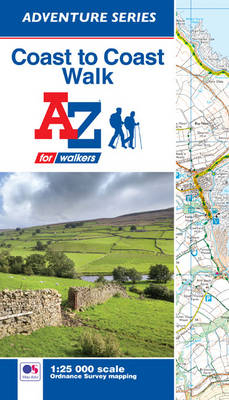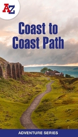
Coast to Coast Adventure Atlas
Seiten
2018
|
3rd Revised edition
Geographers' A-Z Map Co Ltd (Verlag)
978-1-78257-168-1 (ISBN)
Geographers' A-Z Map Co Ltd (Verlag)
978-1-78257-168-1 (ISBN)
- Titel erscheint in neuer Auflage
- Artikel merken
Zu diesem Artikel existiert eine Nachauflage
The A-Z Adventure series features the accuracy and quality of OS Explorer mapping in a convenient book, complete with index.
The A-Z Adventure Series of maps combines the best of OS and A-Z, creating the perfect companion for walkers, off-road cyclists, horse riders and anyone wishing to explore the great outdoors.
The Coast to Coast Walk (C2C) is one of the most popular long distance footpaths in the UK. Devised by Alfred Wainwright, the 180 mile (290km) route starts at St. Bees, on the Irish Sea coast in Cumbria, and passes through three National Parks (the Lake District, Yorkshire Dales, and North York Moors) to finish at Robin Hood's Bay on the North Sea coast.
This A-Z Coast to Coast Walk Adventure Atlas features 72 pages of continuous Ordnance Survey 1:25000 mapping providing complete coverage of the Coast to Coast Walk. This atlas includes a route planner showing distances between places and the amenities available, featuring:
•Information Centres
•Hotels/B&Bs
•Youth Hostels
•Campsites (seasonal opening)
•Public Houses
•Shops
•Restaurants
•Cafes (seasonal opening)
•Petrol Stations
Also featured is advice on safety and security when walking and a selection of QR codes linked to useful websites, including regional information, map reading advice and weather reports.
Unlike the original OS sheets, this A-Z Adventure Atlas includes a comprehensive index to towns, villages, hamlets and locations, natural features, nature reserves, car parks and youth hostels, making it easy to find the required location quickly. Each index entry has a page reference and a six figure National Grid Reference. With a book size of 240mm x 134mm it is the same size as the standard OS map.
Other walks available in the A-Z Adventure series include: Cotswold Way, Hadrian's Wall Path, North Downs Way, Offa's Dyke Path, Pembrokeshire Coast Path, Pennine Way, South Downs Way, SW Coast Path, Thames Path and The Ridgeway.
Britain’s leading street map publisher providing cartographic services, digital data products and paper mapping publications (including Street Atlases, Visitors Guides, Great Britain Road Atlases and The Adventure Atlas).
| Erscheinungsdatum | 18.01.2017 |
|---|---|
| Sprache | englisch |
| Maße | 134 x 240 mm |
| Gewicht | 122 g |
| Themenwelt | Sachbuch/Ratgeber |
| Reisen ► Karten / Stadtpläne / Atlanten ► Europa | |
| Reiseführer ► Europa ► Großbritannien | |
| ISBN-10 | 1-78257-168-X / 178257168X |
| ISBN-13 | 978-1-78257-168-1 / 9781782571681 |
| Zustand | Neuware |
| Haben Sie eine Frage zum Produkt? |
Mehr entdecken
aus dem Bereich
aus dem Bereich
individuell reisen mit vielen praktischen Tipps
Buch | Softcover (2024)
Michael Müller (Verlag)
CHF 43,90
Reiseführer mit Stadtplan, 4 Spaziergängen und kostenloser Web-App
Buch | Softcover (2023)
Reise Know-How (Verlag)
CHF 22,90


