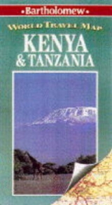
Kenya and Tanzania
1994
|
2nd Revised edition
Bartholomew (Verlag)
978-0-7028-2584-2 (ISBN)
Bartholomew (Verlag)
978-0-7028-2584-2 (ISBN)
- Titel erscheint in neuer Auflage
- Artikel merken
Zu diesem Artikel existiert eine Nachauflage
Revised to include the disputed boundary to the north of Kenya, this map combines layout colouring with hillshading to produce an effective background to the road details. Areas of sand desert, lava fields and forest are all shown, in addition to salt lakes, intermittant rivers, wells and marshes. All the main national parks and game reserves are shown. Roads are divided into one of five different classes ranging from international and regional main roads to unsurfaced tracks. Railways and ferries are also included. There are also detailed city maps of Nairobi and Dar Es Salaam, a politically coloured map showing the districts and regions of the Kenya and Tanzania, and larger-scale inset maps of Mount Kilimanjaro, Mount Kenya, Pemba Island and Zanzibar Island. The key to symbols is in four languages, and there is a comprehensive index to place-names on the reverse. This map is suitable for planning trips to the two countries.
| Erscheint lt. Verlag | 7.7.1994 |
|---|---|
| Reihe/Serie | World Travel Map S. |
| Zusatzinfo | index |
| Verlagsort | Edinburgh |
| Sprache | englisch |
| Maße | 143 x 258 mm |
| Gewicht | 80 g |
| Themenwelt | Reisen ► Karten / Stadtpläne / Atlanten ► Afrika |
| ISBN-10 | 0-7028-2584-0 / 0702825840 |
| ISBN-13 | 978-0-7028-2584-2 / 9780702825842 |
| Zustand | Neuware |
| Haben Sie eine Frage zum Produkt? |
Mehr entdecken
aus dem Bereich
aus dem Bereich
Karte (gefalzt) (2024)
Freytag-Berndt und ARTARIA (Verlag)
CHF 18,95
Karte (gefalzt) (2023)
Freytag-Berndt und ARTARIA (Verlag)
CHF 21,90
reiß- und wasserfest (world mapping project)
Karte (gefalzt) (2024)
Reise Know-How (Verlag)
CHF 17,90


