United States of America Map
1993
|
Revised edition
Bartholomew (Verlag)
978-0-7028-2526-2 (ISBN)
Bartholomew (Verlag)
978-0-7028-2526-2 (ISBN)
- Titel erscheint in neuer Auflage
- Artikel merken
Zu diesem Artikel existiert eine Nachauflage
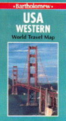
Fully revised and updated, this map extends from Seattle and San Diego on the Western Seaboard to the Western state boundaries of North and South Dakota, Nebraska, Denver and El Paso. The borders of British Columbia, Alberta and Saskatchewan mark the northern limit, Mexico is the southern limit.
Fully revised and updated, this map extends from Seattle and San Diego on the Western Seaboard to the Western state boundaries of North Dakota, South Dakota, Nebraska, Denver and El Paso. The borders of British Columbia, Alberta and Saskatchewan mark the northern limit, Mexico is the southern limit. A detailed physical map with relief shown by a system of layer colouring overlain with additional physical communication detail - salk flats, slat lakes, interstate highways, US highways, roads, railways, canals and airports. Other features include international and state boundaries, state capitals and national parks. There are also inset plans of Los Angeles and the San Francisco Bay area at the enlarged scale of 1:500,000 (eight miles to one inch). The map key is in English, French and German. On the reverse of the map there is comprehensive index of place names. States covered are: Washington, Montana, Oregon, Idaho, Wyoming, California, Nevada, Utah, Colorado (part), Arizona and New Mexico (part).
Fully revised and updated, this map extends from Seattle and San Diego on the Western Seaboard to the Western state boundaries of North Dakota, South Dakota, Nebraska, Denver and El Paso. The borders of British Columbia, Alberta and Saskatchewan mark the northern limit, Mexico is the southern limit. A detailed physical map with relief shown by a system of layer colouring overlain with additional physical communication detail - salk flats, slat lakes, interstate highways, US highways, roads, railways, canals and airports. Other features include international and state boundaries, state capitals and national parks. There are also inset plans of Los Angeles and the San Francisco Bay area at the enlarged scale of 1:500,000 (eight miles to one inch). The map key is in English, French and German. On the reverse of the map there is comprehensive index of place names. States covered are: Washington, Montana, Oregon, Idaho, Wyoming, California, Nevada, Utah, Colorado (part), Arizona and New Mexico (part).
| Erscheint lt. Verlag | 1.11.1993 |
|---|---|
| Reihe/Serie | World Travel S. |
| Zusatzinfo | index |
| Verlagsort | Edinburgh |
| Sprache | englisch |
| Maße | 140 x 260 mm |
| Gewicht | 85 g |
| Themenwelt | Reisen ► Karten / Stadtpläne / Atlanten ► Nord- / Mittelamerika |
| ISBN-10 | 0-7028-2526-3 / 0702825263 |
| ISBN-13 | 978-0-7028-2526-2 / 9780702825262 |
| Zustand | Neuware |
| Haben Sie eine Frage zum Produkt? |
Mehr entdecken
aus dem Bereich
aus dem Bereich
Karte (gefalzt) (2024)
Freytag-Berndt und ARTARIA (Verlag)
CHF 18,95
Karte (gefalzt) (2023)
Reise Know-How (Verlag)
CHF 16,90
Karte (gefalzt) (2023)
Reise Know-How (Verlag)
CHF 16,90


