Scotland A-Z Road Atlas
Seiten
2017
|
New Second edition
Geographers' A-Z Map Co Ltd (Verlag)
978-1-78257-135-3 (ISBN)
Geographers' A-Z Map Co Ltd (Verlag)
978-1-78257-135-3 (ISBN)
- Titel erscheint in neuer Auflage
- Artikel merken
Zu diesem Artikel existiert eine Nachauflage
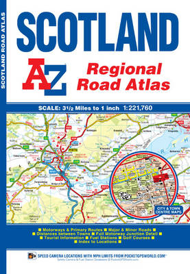
This A-Z map of Scotland is a full colour regional road atlas featuring 92 pages of road mapping covering the whole of the country.
Instantly recognizable and easy to use, A-Z road mapping includes the following features:
•Motorways with full junction detail, primary routes and destinations, A & B roads, under construction and proposed roads, service areas, tolls, mileages, national, county and unitary authority boundaries
•Selected safety camera locations with speed limits
•Selected fuel stations
•Cairngorms and Loch Lomond & The Trossachs National Park boundaries
•Hill shading sourced from Geo-Innovations© www.geoinnovations.co.uk
•Selected places of interest and tourist information centres
The mainland pages scale is 3.5 miles to 1 inch and the Western Isles, Shetland Islands and Orkney Islands scale is 4.5 miles to 1 inch.
Also included are 20 city and town plans for:
•Aberdeen
•Aviemore
•Ayr
•Dumfries
•Dundee
•Dunfermline
•Edinburgh
•Glasgow
•Falkirk
•Fort William
•Hamilton
•Inverness
•Kilmarnock
•Kirkcaldy
•Motherwell
•Oban
•Paisley
•Perth
•St Andrews
•Stirling
There is a comprehensive index to cities, towns, villages, hamlets and locations.
Britain’s leading street map publisher providing cartographic services, digital data products and paper mapping publications (including Street Atlases, Visitors Guides, Great Britain Road Atlases and The Adventure Atlas).
| Erscheinungsdatum | 08.08.2016 |
|---|---|
| Sprache | englisch |
| Maße | 170 x 245 mm |
| Gewicht | 260 g |
| Themenwelt | Sachbuch/Ratgeber |
| Reisen ► Karten / Stadtpläne / Atlanten ► Europa | |
| ISBN-10 | 1-78257-135-3 / 1782571353 |
| ISBN-13 | 978-1-78257-135-3 / 9781782571353 |
| Zustand | Neuware |
| Haben Sie eine Frage zum Produkt? |


