The Snowdonia Way
Cicerone Press (Verlag)
978-1-85284-856-9 (ISBN)
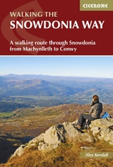
Guidebook to walking the Snowdonia Way through Eryri (Snowdonia) National Park in Wales, from Machynlleth to Conwy, with low and high-level mountain options.
The 97 mile (156km) low-level route is described over 6 stages of between 13 and 21 miles (21–34km) whereas the mountain route covers 122 miles in 9 stages of 12 to 18 miles (19–29km).
Route description illustrated with 1:50,000 OS mapping
Crosses the heart of Eryri (Snowdonia) via Dolgellau, Trawsfynydd, Beddgelert, Dolwyddelan, Capel Curig and Bethesda
Mountain route takes in Cadair Idris, Yr Wyddfa (Snowdon) and the Glyders
The low-level route involves long days but mainly easy walking; the high-level route includes more challenging navigation, considerable ascent and some pathless terrain
Since they intersect regularly, it is possible to mix and match between the low and high-level routes
Information on facilities and selective accommodation listings
Notes on geology, history, plants, wildlife and folklore
Alex Kendall is a mountain leader, working in summer and winter throughout the UK and abroad, leading groups on day walks, challenges and long distance journeys. He enjoys getting people into the outdoors, especially through supervising Duke of Edinburgh's Award expeditions and running weekend walking trips for adults. He has been walking in Eryri (Snowdonia) for over 10 years having been introduced to these mountains as a student.
CONTENTS
Map key
Transport map
Overview map
Route summary table
Introduction
The Snowdonia Way
Landscape
Plants and wildlife
Geology
History
Understanding Welsh
When to go
Getting there
Accommodation
Planning your itinerary
Route difficulty
What to take
Maps and GPS
Safety
Using this guide
The Snowdonia Way
Stage 1 Machynlleth to Dolgellau
Stage 1A Machynlleth to Abergynolwyn (mountain route)
Stage 1B Abergynolwyn to Dolgellau (mountain route)
Stage 2 Dolgellau to Trawsfynydd
Stage 2A Dolgellau to Trawsfynydd (mountain route)
Stage 3 Trawsfynydd to Beddgelert
Stage 3A Trawsfynydd to Penrhyndeudraeth (mountain route)
Stage 3B Penrhyndeudraeth to Beddgelert (mountain route)
Stage 4 Beddgelert to Dolwyddelan
Stage 4A Beddgelert to Pen-y-Pass (mountain route)
Stage 4B Pen-y-Pass to Capel Curig (mountain route)
Stage 5 Dolwyddelan to Bethesda
Stage 5A Capel Curig to Bethesda (mountain route)
Stage 6 Bethesda to Conwy
Stage 6A Bethesda to Conwy (mountain route)
Appendix A Accommodation
Appendix B Facilities tables
Appendix C Useful contacts
Appendix D Further reading
| Erscheinungsdatum | 21.02.2017 |
|---|---|
| Reihe/Serie | Cicerone guidebooks |
| Verlagsort | Kendal |
| Sprache | englisch |
| Maße | 116 x 172 mm |
| Gewicht | 230 g |
| Themenwelt | Sachbuch/Ratgeber ► Sport |
| Reiseführer ► Europa ► Großbritannien | |
| Reisen ► Sport- / Aktivreisen ► Europa | |
| ISBN-10 | 1-85284-856-1 / 1852848561 |
| ISBN-13 | 978-1-85284-856-9 / 9781852848569 |
| Zustand | Neuware |
| Haben Sie eine Frage zum Produkt? |
aus dem Bereich