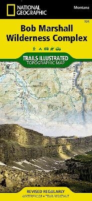
Bob Marshall Wilderness
Seiten
2016
|
2020th ed.
National Geographic Maps (Verlag)
978-1-59775-626-6 (ISBN)
National Geographic Maps (Verlag)
978-1-59775-626-6 (ISBN)
- Keine Verlagsinformationen verfügbar
- Artikel merken
Waterproof, Tear-Resistant Topographic Map. Explore the wonders of the Bob Marshall Wilderness Complex with National Geographic's Bob Marshall Wilderness Trails Illustrated Map. This area includes four national forests and the Great Bear, Bob Marshall, and Scapegoat Wilderness Areas. Encompassing the highest concentration of grizzlies in the continental U.S., this region extends from Seeley Lake in the South to the northern tip of Hungry Horse Reservoir and spreads East to Glacier National Park, with all of Sun Valley on the West. This expertly researched and highly detailed map includes the Flathead and Swan Mountain Ranges, the 'Chinese Wall' along the Continental Divide, the renowned Jewel Basin, and the Sun River Game Preserve. Also depicted are the South Fork and the southern section of the Middle Fork of the Flathead Wild River. This map will guide you through stunning wilderness with miles of mapped trails and clearly marked trailheads. Every Trails Illustrated map is printed o
| Erscheint lt. Verlag | 26.2.2016 |
|---|---|
| Verlagsort | Evergreen |
| Sprache | englisch |
| Maße | 110 x 235 mm |
| Themenwelt | Reisen ► Karten / Stadtpläne / Atlanten ► Nord- / Mittelamerika |
| Reiseführer ► Nord- / Mittelamerika ► USA | |
| ISBN-10 | 1-59775-626-1 / 1597756261 |
| ISBN-13 | 978-1-59775-626-6 / 9781597756266 |
| Zustand | Neuware |
| Haben Sie eine Frage zum Produkt? |
Mehr entdecken
aus dem Bereich
aus dem Bereich
Karte (gefalzt) (2024)
Michelin Editions des Voyages (Verlag)
CHF 20,55
Map
Karte (gefalzt) (2024)
Michelin Editions des Voyages (Verlag)
CHF 15,90


