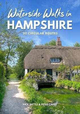
Waterside Walks in Hampshire
Countryside Books (Verlag)
978-1-84674-339-9 (ISBN)
With everything from crystal-clear chalk streams to spectacular coastline, it's no exaggeration to say that Hampshire is blessed with some of the country's most beautiful water.
These 20 Hampshire walks show off the county at its best. You'll explore famous rivers with walks along the Test and the Itchen, as well the lesser-known but equally attractive Wey, Dever and Alre. There are routes along peaceful tidal stretches, including the Beaulieu at Buckler's Hard and the Hamble at Bursledon, as well as glorious coastal walks on the Solent shore at Calshot and Pennington.
The walks, which vary in length between 2 and 5 miles, are all circular and easy to follow. Each one offers an outing of discovery through some of the best of Hampshire's rich countryside.
Peter Carne was a great walking enthusiast and the author of a number of walking guides in Hampshire and the New Forest. Nick Battle, Peter's publisher, and his family have kept the book up-to-date, regularly rewalking the routes.
The Walks: 1.Stockbridge & the River Test (2 miles)
2.Bishopstoke & the River Itchen(5 miles)
3.Shawford & the Itchen Valley (2 miles)
4.Ovington & Itchen Stoke(11/2 miles)
5.Alresford & the River Alre (33/4 miles)
6.Romsey & the Andover Canal(31/4 miles)
7.Wherwell & the Test Way (3 miles)
8.Barton Stacey & the River Dever(41/4 miles)
9.The Test at Whitchurch & Laverstoke(53/4 miles)
10.Micheldever & the Dever Valley(31/2 miles)
11.Dogmersfield & the Basingstoke Canal(31/4 miles)
12.Froyle & the Wey Valley(5 miles)
13.Droxford & the River Meon(21/4 miles)
14.Wallington's River Estuary(41/4 miles)
15.Titchfield & the Lower Meon Valley(51/4 miles)
16.Bursledon & the Hamble Estuary(43/4 miles)
17.Calshot & Southampton Water(41/4 miles)
18.Buckler's Hard & the Beaulieu River(41/2 miles)
19.Pennington & the Solent Shore(3 miles)
20.Ringwood & the Avon Valley Path (43/4 miles)
| Erscheinungsdatum | 27.07.2017 |
|---|---|
| Reihe/Serie | Waterside Walks |
| Zusatzinfo | full colour photographs and illustrated maps throughout |
| Verlagsort | Berks |
| Sprache | englisch |
| Maße | 150 x 210 mm |
| Gewicht | 220 g |
| Themenwelt | Sachbuch/Ratgeber ► Gesundheit / Leben / Psychologie ► Lebenshilfe / Lebensführung |
| Sachbuch/Ratgeber ► Sport | |
| Reiseführer ► Europa ► Großbritannien | |
| ISBN-10 | 1-84674-339-7 / 1846743397 |
| ISBN-13 | 978-1-84674-339-9 / 9781846743399 |
| Zustand | Neuware |
| Haben Sie eine Frage zum Produkt? |
aus dem Bereich


