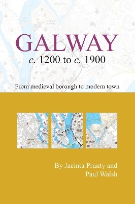
Galway c.1200 to c.1900: from medeival borough to modern city
Seiten
2015
Royal Irish Academy (Verlag)
978-1-908996-83-1 (ISBN)
Royal Irish Academy (Verlag)
978-1-908996-83-1 (ISBN)
This map shows historic Galway plotted onto a detailed modern base. Over 200 sites and streets,many of which no longer survive in the present-day are depicted in colour and listed in an accompanying index. An attached booklet contains a commentary on the urban development of Galway and gives a chronological list of sites included on the map.
This pocket map from the Irish Historic Towns Atlas shows historic Galway plotted onto a detailed Ordnance Survey Ireland modern base. Over 200 sites and streets covering 700 years are depicted in colour and listed in an accompanying index. Town walls, bridges, churches, gallows, public buildings, schools, theatres and wells are among the sites shown, many of which no longer survive in the present-day cityscape. An ideal aid for a walking tour of the historic town, the map (940 x 705 mm) is folded to pocket size and accompanied by a booklet with a commentary on the urban development of Galway by authors Jacinta Prunty and Paul Walsh. The map is based on work in progress for the Irish Historic Towns Atlas of Galway by the same authors, which is due for publication in 2016. Similar maps have been produced by the Irish Historic Towns Atlas project for Belfast, Dublin, Limerick and New Ross.
Authors: Jacinta Prunty, Paul Walsh; Cartography: Sarah Gearty
Series editors: Anngret Simms, H.B. Clarke, Raymond Gillespie, Jacinta Prunty; Consultant editor: J.H. Andrews; Cartographic editor: Sarah Gearty; Editorial assistants: Angela Murphy, Jennifer Moore, Frank Cullen.
| Reihe/Serie | Irish Historic Towns Atlas |
|---|---|
| Mitarbeit |
Karten von: Sarah Gearty |
| Verlagsort | Dublin |
| Sprache | englisch |
| Maße | 705 x 980 mm |
| Gewicht | 132 g |
| Themenwelt | Reisen ► Karten / Stadtpläne / Atlanten ► Europa |
| Reisen ► Karten / Stadtpläne / Atlanten ► Welt / Arktis / Antarktis | |
| ISBN-10 | 1-908996-83-8 / 1908996838 |
| ISBN-13 | 978-1-908996-83-1 / 9781908996831 |
| Zustand | Neuware |
| Haben Sie eine Frage zum Produkt? |
Mehr entdecken
aus dem Bereich
aus dem Bereich
Straßen- und Freizeitkarte 1:250.000
Karte (gefalzt) (2023)
Freytag-Berndt und ARTARIA (Verlag)
CHF 19,90
Karte (gefalzt) (2023)
Freytag-Berndt und ARTARIA (Verlag)
CHF 19,90
Östersund
Karte (gefalzt) (2023)
Freytag-Berndt und ARTARIA (Verlag)
CHF 21,90


