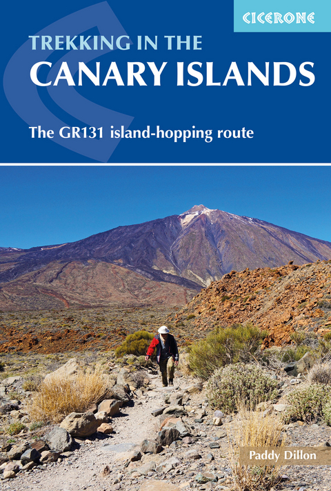
Trekking in the Canary Islands
Cicerone Press (Verlag)
978-1-85284-765-4 (ISBN)
A guidebook to trekking the 560km (348 mile) GR131 across the Canary Islands. The island-hopping long-distance trail crosses Lanzarote, Fuerteventura, Gran Canaria, Tenerife, La Gomera, La Palma and El Hierro and can be hiked in around a month, or split into shorter sections. Most of the route uses quiet roads, tracks and old mule paths, but there are some remote stretches, as well as occasional steep and rocky mountain paths.
The route is presented in 32 stages of between 7 and 30km (4–18 miles). Also included is an optional ascent of Spain’s highest peak, El Teide on Tenerife.
Clear route description illustrated with 1:50,000 mapping
GPX files available to download
Notes on accommodation, refreshments and local transport
Information on ferry transfers between the islands
Sized to easily fit in a jacket pocket
Paddy Dillon is a prolific walker and guidebook writer with over 90 guidebooks to his name, and contributions to 40 other titles. He has written extensively for several outdoor magazines and other publications and has appeared on radio and television. Paddy is an indefatigable long-distance walker who has walked all of Britain's National Trails and several European trails. He has also walked in Nepal, Tibet, Korea, Africa and the Rocky Mountains of Canada and the US. Paddy is a member of the Outdoor Writers and Photographers Guild and President of the Backpackers Club.
Map key
Overview map of the Canary Islands
Route summary table
Introduction
Location
Geology
Brief history of the Canary Islands
Plants and animals
Travel to the Canary Islands
Travel around the Canary Islands
When to go
Accommodation
Language
Money
Food and drink
Trekking the GR131
Using this guide
Emergencies
Lanzarote
Stage 1 Órzola to Haría
Stage 2 Haría to Teguise
Stage 3 Teguise to Montaña Blanca
Stage 4 Montaña Blanca to Yaiza
Stage 5 Yaiza to Playa Blanca
Fuerteventura
Stage 6 Islote de Lobos
Stage 7 Corralejo to La Oliva
Stage 8 La Oliva to Tefía
Stage 9 Tefía to Betancuria
Stage 10 Betancuria to P&##xe1;jara
Stage 11 P&##xe1;jara to La Pared
Stage 12 La Pared to Barranco de Pecenescal
Stage 13 Barranco de Pecenescal to Morro Jable
Stage 14 Morro Jable to Faro de Jandía
Gran Canaria
Stage 15 Faro de Maspalomas to Ayagaures
Stage 16 Ayagaures to Tunte
Stage 17 Tunte to Cruz de Tejeda
Stage 18 Cruz de Tejeda to Tamadaba
Stage 19 Tamadaba to Puerto de las Nieves
Tenerife
Stage 20 La Esperanza to La Caldera
Stage 21 La Caldera to El Portillo
Optional route Ascent of El Teide
Stage 22 El Portillo to Parador
Stage 23 Parador to Vilaflor
Stage 24 Vilaflor to Arona
La Gomera
Stage 25 San Sebasti&##xe1;n to Chipude
Stage 26 Chipude to Playa de Vallehermoso
La Palma
Stage 27 Faro de Fuencaliente to Fuencaliente
Stage 28 Fuencaliente to Refugio El Pilar
Stage 29 Refugio El Pilar to Roque de los Muchachos
Stage 30 Roque de los Muchachos to Puerto de Tazacorte
El Hierro
Stage 31 Puerto de la Estaca or Tamaduste to Fuente de La Llanía
Stage 32 Fuente de La Llanía to Embarcadero de Orchilla
Appendix A Language notes
Appendix B Useful contacts
| Erscheinungsdatum | 08.01.2020 |
|---|---|
| Reihe/Serie | Cicerone guidebooks |
| Zusatzinfo | 40 maps and 80 colour photos |
| Verlagsort | Kendal |
| Sprache | englisch |
| Maße | 116 x 172 mm |
| Gewicht | 300 g |
| Themenwelt | Sachbuch/Ratgeber ► Sport |
| Reiseführer ► Europa ► Spanien | |
| Reiseführer ► Afrika ► Marokko | |
| Reisen ► Reiseführer ► Welt / Arktis / Antarktis | |
| Reisen ► Sport- / Aktivreisen ► Europa | |
| ISBN-10 | 1-85284-765-4 / 1852847654 |
| ISBN-13 | 978-1-85284-765-4 / 9781852847654 |
| Zustand | Neuware |
| Informationen gemäß Produktsicherheitsverordnung (GPSR) | |
| Haben Sie eine Frage zum Produkt? |
aus dem Bereich


