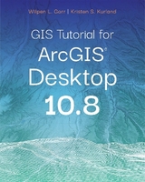
GIS Tutorial 1
Environmental Systems Research Institute Inc.,U.S. (Verlag)
978-1-58948-456-6 (ISBN)
- Titel erscheint in neuer
- Artikel merken
This book published in 2016 for an earlier version of ArcGIS Desktop; updated version coming in Summer 2020
GIS Tutorial 1: Basic Workbook is a top-selling introductory text for learning ArcGIS 10.3.x for Desktop. The workbook presents GIS tools and functionality, including querying interactive maps, collecting data, and running geoprocessing tools. Incorporating proven teaching methods in detailed exercises, "Your Turn" sections, and homework assignments, this book is suited to learning GIS in a classroom. The latest edition includes a new chapter about analyzing street network data to solve routing and facility location problems using ArcGIS Network Analyst. Data for completing the exercises is available for download. Instructor resources are also available.
This book published in 2016 for an earlier version of ArcGIS Desktop. A new edition is anticipated in Summer 2020 for the latest version of ArcGIS Desktop.
Wilpen L. Gorr is a professor of public policy and management information systems at the H. John Heinz III School of Public Policy and Management, Carnegie Mellon University, where he teaches and researches GIS applications. Kristen S. Kurland holds a joint faculty appointment at Carnegie Mellon University's Heinz School of Public Policy and Management and School of Architecture, where she teaches GIS, CAD, 3D Visualization, and Computer Aided Facilities Management (CAFM).
Preface
Acknowledgments
Part I Using and making maps
Chapter 1: Introduction
Tutorial 1-1 Opening and saving a map document
Tutorial 1-2 Working with map layers
Tutorial 1-3 Navigating in a map document
Tutorial 1-4 Measuring distances
Tutorial 1-5 Working with feature attributes
Tutorial 1-6 Selecting features
Tutorial 1-7 Changing selection options
Tutorial 1-8 Working with attribute tables
Tutorial 1-9 Labeling features
Assignment 1-1 Analyze population by race in the top 10 US state
Assignment 1-2 Produce a crime map
Chapter 2: Map design
Tutorial 2-1 Creating point and polygon maps using qualitative attributes
Tutorial 2-2 Creating point and polygon maps using quantitative attributes
Tutorial 2-3 Creating custom classes for a map
Tutorial 2-4 Creating custom colors for a map
Tutorial 2-5 Creating normalized and density maps
Tutorial 2-6 Creating dot density maps
Tutorial 2-7 Creating fishnet maps
Tutorial 2-8 Creating group layers and layer packages
Assignment 2-1 Create a map showing schools in New York City by type
Assignment 2-2 Create maps for military sites and congressional districts
Assignment 2-3 Create maps for US veteran unemployment status
Chapter 3: GIS outputs
Tutorial 3-1 Building an interactive GIS
Tutorial 3-2 Creating map layouts
Tutorial 3-3 Reusing a custom map layout
Tutorial 3-4 Creating a custom map template with two maps
Tutorial 3-5 Adding a report to a layout
Tutorial 3-6 Adding a graph to a layout
Tutorial 3-7 Building a map animation
Tutorial 3-8 Using ArcGIS Online
Assignment 3-1 Create a dynamic map of historic buildings in downtown Pittsburgh
Assignment 3-2 Create a layout comparing 2010 elderly and youth population compositions in Orange County, California
Assignment 3-3 Create an animation for an auto theft crime time series
Assignment 3-4 Create a shared map on ArcGIS Online
Part II Working with spatial data
Chapter 4: File geodatabases
Tutorial 4-1 Building a file geodatabase
Tutorial 4-2 Using ArcCatalog utilities
Tutorial 4-3 Modifying an attribute table
Tutorial 4-4 Joining tables
Tutorial 4-5 Creating centroid coordinates in a table
Tutorial 4-6 Aggregating data
Assignment 4-1 Investigate educational attainment
Assignment 4-2 Compare serious crime with poverty in Pittsburgh
Chapter 5: Spatial data
Tutorial 5-1 Examining metadata
Tutorial 5-2 Working with world map projections
Tutorial 5-3 Working with US map projections
Tutorial 5-4 Working with rectangular coordinate systems
Tutorial 5-5 Learning about vector data formats
Tutorial 5-6 Downloading US Census Bureau boundary maps
Tutorial 5-7 Downloading and processing Census SF 1 data tables
Tutorial 5-8 Downloading and processing American Community Survey (ACS) Census data
Tutorial 5-9 Exploring raster basemaps from Esri web services
Tutorial 5-10 Downloading raster maps from the USGS
Tutorial 5-11 Exploring sources of GIS data from government websites
Assignment 5-1 Compare heating fuel types by US counties
Assignment 5-2 Create a map of Maricopa County, Arizona, voting districts, schools, and voting-age population using downloaded data and a web service image
Chapter 6: Geoprocessing
Tutorial 6-1 Extracting features for a study area
Tutorial 6-2 Clipping features
Tutorial 6-3 Dissolving features
Tutorial 6-4 Merging features
Tutorial 6-5 Intersecting layers
Tutorial 6-6 Unioning layers
Tutorial 6-7 Automating geoprocessing with ModelBuilder
Assignment 6-1 Build a study region for Colorado counties
Assignment 6-2 Dissolve property parcels to create a zoning map
Assignment 6-3 Build a model to create a fishnet map layer for a study area
Chapter 7: Digitizing
Tutorial 7-1 Digitizing polygon features
Tutorial 7-2 Digitizing line features
Tutorial 7-3 Digitizing point features
Tutorial 7-4 Using advanced editing tools
Tutorial 7-5 Spatially adjusting features
Assignment 7-1 Digitize police beats
Assignment 7-2 Use GIS to track campus information
Chapter 8: Geocoding
Tutorial 8-1 Geocoding data by ZIP Code
Tutorial 8-2 Geocoding data by street address
Tutorial 8-3 Correcting source addresses using interactive rematch
Tutorial 8-4 Using ArcGIS Online for geocoding across the United States
Tutorial 8-5 Correcting street reference layer addresses
Tutorial 8-6 Using an alias table
Assignment 8-1 Geocode household hazardous waste participants to ZIP Codes
Assignment 8-2 Geocode immigrant-run businesses to Pittsburgh streets
Assignment 8-3 Examine match option parameters for geocoding
Part III Analyzing spatial data
Chapter 9: Spatial analysis
Tutorial 9-1 Buffering points for proximity analysis
Tutorial 9-2 Conducting a site suitability analysis
Tutorial 9-3 Using multiple ring buffers for calibrating a gravity model
Tutorial 9-4 Using data mining with cluster analysis
Assignment 9-1 Analyze population in California cities at risk for earthquakes
Assignment 9-2 Analyze visits to the Jack Stack public pool in Pittsburgh
Assignment 9-3 Use data mining with crime data
Chapter 10: ArcGIS 3D Analyst for Desktop
Tutorial 10-1 Creating a 3D scene
Tutorial 10-2 Creating a TIN (triangulated irregular network) from contours
Tutorial 10-3 Draping features onto a TIN
Tutorial 10-4 Navigating scenes
Tutorial 10-5 Creating an animation
Tutorial 10-6 Using 3D effects
Tutorial 10-7 Using 3D symbols
Tutorial 10-8 Editing 3D objects
Tutorial 10-9 Using ArcGIS 3D Analyst for landform analysis
Tutorial 10-10 Exploring ArcGlobe
Assignment 10-1 Develop a 3D presentation for downtown historic sites
Assignment 10-2 Topographic site analysis
Assignment 10-3 3D animation of conservatory study area
Chapter 11: ArcGIS Spatial Analyst for Desktop
Tutorial 11-1 Processing raster map layers
Tutorial 11-2 Creating a hillshade raster layer
Tutorial 11-3 Making a kernel density map
Tutorial 11-4 Extracting raster value points
Tutorial 11-5 Conducting a raster-based site suitability study
Tutorial 11-6 Using ModelBuilder for a risk index
Assignment 11-1 Create a mask and hillshade for suburbs
Assignment 11-2 Estimate heart-attack fatalities outside of hospitals by gender
Chapter 12: ArcGIS Network Analyst for Desktop
Tutorial 12-1 Solving the traveling salesman problem
Tutorial 12-2 Building a TIGER-based network dataset
Tutorial 12-3 Creating travel polygons
Tutorial 12-4 Locating facilities
Tutorial 12-5 Routing vehicles from depots to demand points
Assignment 12‐1 Geographic Access to Federally Qualified Health Centers
Assignment 12-2 Analyze visits to the Phillips public pool in Pittsburgh
Appendix A: Task index
Appendix B: Data source credits
Appendix C: Data license agreement
| Erscheinungsdatum | 02.04.2016 |
|---|---|
| Reihe/Serie | GIS Tutorials |
| Zusatzinfo | Color and black and white illustrations, photographs, charts, and maps. |
| Verlagsort | Redlands |
| Sprache | englisch |
| Maße | 203 x 254 mm |
| Themenwelt | Reisen ► Reiseführer |
| Naturwissenschaften ► Geowissenschaften ► Geografie / Kartografie | |
| Technik ► Elektrotechnik / Energietechnik | |
| ISBN-10 | 1-58948-456-8 / 1589484568 |
| ISBN-13 | 978-1-58948-456-6 / 9781589484566 |
| Zustand | Neuware |
| Informationen gemäß Produktsicherheitsverordnung (GPSR) | |
| Haben Sie eine Frage zum Produkt? |
aus dem Bereich


