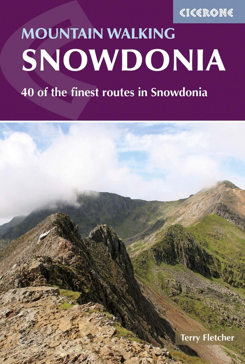
Mountain Walking in Snowdonia
Cicerone Press (Verlag)
978-1-85284-767-8 (ISBN)
A guidebook to 40 mountain walks exploring Eryri (Snowdonia), Wales. Graded by difficulty, the routes cover the whole of the national park and range from easy to strenuous, with the majority falling into the ‘moderate’ and ‘strenuous’ categories. Four routes call for low-grade scrambling.
Included are 38 walks of between 5 and 20km (3–13 miles), which can be enjoyed in 2–7 hours, plus a challenging two-day traverse of ‘the Welsh 3000s’ – the 15 Welsh summits over 3000ft.
1:50,000 OS maps included for each walk
Sized to easily fit in a jacket pocket
Handy route summary table to help you choose an appropriate route
Access and parking information provided for each route
Geology, history, wildlife and a Welsh–English glossary
Terry Fletcher has been walking and climbing in Snowdonia for almost 50 years since first visiting the Llanberis Pass as an awestruck teenage rock climber. He has been a full-time professional writer for more than 40 years, writing for almost every national newspaper as well as specialist magazines and appearing on television and radio to comment on the outdoors.
Map key
Overview map
Introduction
Geology
History
Wildlife
Getting there
Getting around
Where to stay
When to go
Equipment
Mountain rescue
Using this guide
Place names
The Carneddau
Walk 1 Tal y Fan
Walk 2 Aber Falls and the Northern Carneddau
Walk 3 Cwm Eigiau Horseshoe
Walk 4 The Southern Carneddau
Walk 5 Cwm Llafar Horseshoe
The Glyderau
Walk 6 Gallt yr Ogof and Y Foel Goch
Walk 7 Glyderau from Pen-y-Gwryd
Walk 8 Tryfan by the North Ridge and Heather Terrace
Walk 9 Tryfan Without Fears
Walk 10 Cwm Bochlwyd and Glyder Fach
Walk 11 Y Garn and the Devil's Kitchen
Walk 12 Elidir Fawr and Y Garn
Betws-y-Coed
Walk 13 Llyn Crafnant and Llyn Geirionydd
Walk 14 Llyn y Parc and Conwy View
Snowdon
Walk 15 Moel Eilio Horseshoe
Walk 16 Snowdon Horseshoe
Walk 17 Snowdon via Miners' Track and PyG Track
Walk 18 Lliwedd via Miners' Track and Y Gribin
Walk 19 Snowdon via the Watkin and the Rhyd Dhu Paths
Walk 20 Yr Aran
Eifionedd
Walk 21 Cwm Pennant and the Moel Hebog Ridge
Walk 22 Mynydd Mawr
Walk 23 Nantlle Ridge
Siabod and the Moelwyns
Walk 24 Moel Siabod
Walk 25 Aberglaslyn Gorge and Llyn Dinas
Walk 26 Cnicht and Cwm Croesor
Walk 27 The Moelwyns
The Rhinogs
Walk 28 Rhinog Fawr by the Roman Steps
Walk 29 Rhinog Fach and Y Llethr
Dolgellau, Cadair Idris and the South
Walk 30 Precipice Walk, Dolgellau
Walk 31 Cadair Idris by the Pony Path
Walk 32 Cadair Idris from Minffordd
Walk 33 The Dolgoch Falls and Tarrenhendre
Bala
Walk 34 Rhobell Fawr
Walk 35 Cwm Cywarch Horseshoe and Aran Fawddwy
Walk 36 Traverse of the Aran Ridge
Walk 37 Arenig Fawr and Moel Llyfnant
Walk 38 Cadair Berwyn and Pistyll Rhaeadr
The Welsh 3000s
Day 1 Snowdon and the Glyderau
Day 2 Carneddau
Appendix A Route summary table
Appendix B Welsh/English glossary
Appendix C Useful contacts
| Erscheint lt. Verlag | 19.10.2020 |
|---|---|
| Reihe/Serie | Cicerone guidebooks |
| Zusatzinfo | 40 colour maps, 123 colour photos |
| Verlagsort | Kendal |
| Sprache | englisch |
| Maße | 116 x 172 mm |
| Gewicht | 250 g |
| Themenwelt | Sachbuch/Ratgeber ► Sport |
| Reiseführer ► Europa ► Großbritannien | |
| Reisen ► Sport- / Aktivreisen ► Europa | |
| ISBN-10 | 1-85284-767-0 / 1852847670 |
| ISBN-13 | 978-1-85284-767-8 / 9781852847678 |
| Zustand | Neuware |
| Haben Sie eine Frage zum Produkt? |
aus dem Bereich


