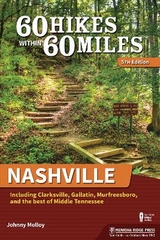
60 Hikes Within 60 Miles: Nashville
Menasha Ridge Press Inc. (Verlag)
978-1-63404-062-4 (ISBN)
- Titel erscheint in neuer Auflage
- Artikel merken
Nashville is best known as the capital of country music. But, located in the Cumberland River Valley surrounded by hills of the Highland Rim, the middle Tennessee city is also home to a great variety of hiking trails. With new hikes and updated maps, trailhead directions, and photos, the new edition of 60 Hikes Within 60 Miles: Nashville by veteran Tennessee outdoorsman Johnny Molloy gives outdoors enthusiasts plenty of hikes to choose from. From historical hikes (like the Gordon House and Ferry Site Walk and the Confederate Earthworks Walk) to great recreational trails (like the Anderson Fitness Trail and the Couchville Lake Loop), hikers of all ages and fitness levels will find a trail to their liking within a short drive from home.
Johnny Molloy is an outdoor writer who averages more than 100 nights in the wild per year backpacking throughout the U.S. He has written more than 30 outdoor guidebooks and articles for magazines and websites. Visit him on the Web at johnnymolloy.com. He lives in Johnson City, TN.
Overview Map
Acknowledgments
Foreword
Preface
60 Hikes by Category
Introduction
NASHVILLE
Bells Bend Loop
Bryant Grove Trail
Couchville Lake Trail
Ganier Ridge Loop
Harpeth Woods Trail
Jones Mill Trail
MetroCenter Levee Greenway
Mill Creek Greenway
Mossy Ridge Trail
Old Hickory Lake Nature Trail
Peeler Park Hike
Richland Creek Greenway: McCabe Loop
Shelby Bottoms Nature Park: East Loop
Shelby Bottoms Nature Park: West Loop
South Radnor Lake Loop
Stones River Greenway of Nashville
Volunteer-Day Loop
Warner Woods Trail
WEST (including Ashland City, Clarksville, and Dickson)
Confederate Earthworks Walk
Cumberland River Bicentennial Trail
Dunbar Cave State Natural Park Loop
Fort Donelson Battlefield Loop
Henry Hollow Loop
Hidden Lake Double Loop
Johnsonville State Historic Park Loop
Montgomery Bell Northeast Loop
Montgomery Bell Southwest Loop
Narrows of Harpeth Hike
Nathan Bedford Forrest Five-Mile Trail
Ridgetop Trail at Beaman Park
SOUTHWEST (including Columbia, Fairview, and Franklin)
Devil’s Backbone Loop
Gordon House and Ferry Site Walk
Heritage Park/Thompson’s Station Park Hike
Lakes of Bowie Loop
Meriwether Lewis Loop
Old Trace-Garrison Creek Loop
Perimeter Trail
SOUTHEAST (including Brentwood, Murfreesboro, and Smyrna)
Adeline Wilhoite River Trail
Brenthaven Bikeway Connector
Cheeks Bend Bluff View Trail
Flat Rock Cedar Glades and Barrens Hike
Hickory Ridge Trail
Old Mill Trail
Old Stone Fort Loop
Short Springs State Natural Area Hike
Smith Park Hike
Stones River Greenway of Murfreesboro
Stones River National Battlefield Loop
Twin Forks Trail
Wild Turkey Trail
EAST (including Gallatin, Hendersonville, Lebanon, and Mount Juliet)
Bearwaller Gap Hiking Trail
Bledsoe Creek State Park Loop
Cedar Forest Trail
Collins River Nature Trail
Eagle Trail
Edgar Evins State Park Hike
Hidden Springs Trail
Sellars Farm State Archaeological Area
Vesta Glade Trail
Wilderness Trail
Appendix A: Outdoor Shops
Appendix B: Places to Buy Maps
Appendix C: Hiking Clubs
Index
About the Author
Map Legend
| Erscheint lt. Verlag | 5.5.2016 |
|---|---|
| Reihe/Serie | 60 Hikes Within 60 Miles |
| Zusatzinfo | B&W photos throughout, 65 maps, 60 charts, tables |
| Verlagsort | Birmingham |
| Sprache | englisch |
| Maße | 152 x 228 mm |
| Gewicht | 340 g |
| Themenwelt | Sachbuch/Ratgeber ► Sport |
| Reiseführer ► Nord- / Mittelamerika ► USA | |
| ISBN-10 | 1-63404-062-7 / 1634040627 |
| ISBN-13 | 978-1-63404-062-4 / 9781634040624 |
| Zustand | Neuware |
| Informationen gemäß Produktsicherheitsverordnung (GPSR) | |
| Haben Sie eine Frage zum Produkt? |
aus dem Bereich


