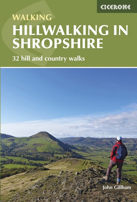
Hillwalking in Shropshire
Cicerone Press (Verlag)
978-1-85284-807-1 (ISBN)
A guidebook to 32 day walks in Shropshire, exploring the hills, outcrops, rivers and towns of this beautiful county. The routes are graded according to difficulty, ensuring there is something for all levels of fitness and experience, and the majority are located within the Shropshire Hills National Landscape.
The walks range from 5–22km (3–14 miles) in length and can be completed in between 2 and 8 hours. They are arranged geographically, mostly falling in the area bounded by Shrewsbury, Bridgnorth, Ludlow and Welshpool.
1:50,000 OS maps reproduced at 1:40,000 for greater clarity
GPX files available to download
Details of terrain, refreshments and public transport for each walk
Information given on local geology and wildlife
Includes accommodation listings arranged by area
Easy access from Birmingham, Oswestry and Manchester
John Gillham has been a professional writer, illustrator and photographer since 1989. His first book was Snowdonia to the Gower: a Coast-to-Coast Walk Across Highest Wales. He also pioneered three other long-distance routes: Lakeland to Lindisfarne, Pennine Ways and the Bowland-Dales Traverse, all of which were published in book form. John-s recent books include The Pictorial Guides to the Mountains of Snowdonia Volumes 1-4, Best Day Walks in Snowdonia and the AA Leisure Guide to Wales. John writes for several outdoor publications, and two of his books have won the Outdoor Writers & Photographers Guild Award for Excellence.
Map key
Overview map
Introduction
Shropshire geology (by Ronald Turnbull)
History
Plants and wildlife
Getting there
Getting around
When to go
Bases for the Shropshire hills
Maps and GPS
Safety
Using this guide
The walks
Walk 1 Llanfair Hill and Offa's Dyke
Walk 2 Knighton, Cwm-sanaham Hill and Offa's Dyke
Walk 3 Mary Knoll and Ludlow
Walk 4 Titterstone Clee Hill
Walk 5 The Bury Ditches
Walk 6 Burrow Fort and Hopesay Hill
Walk 7 Norton Camp and Stokesay Castle
Walk 8 Callow Hill and Flounders Folly
Walk 9 Brown Clee Hill and Stanbroughs Wood
Walk 10 Brown Clee Hill and Clee Liberty
Walk 11 High Rock, Bridgnorth and the River Severn
Walk 12 Bromlow Callow and Mitchell's Fold
Walk 13 Nipstone Rock
Walk 14 Stiperstones
Walk 15 Snailbeach and the Castle Ring fort
Walk 16 Norbury Hill from Wentnor
Walk 17 Minton Hill and the Packet Stone
Walk 18 Adstone Hill
Walk 19 Pole Bank and Devil's Mouth
Walk 20 The Long Mynd and Ragleth Hill
Walk 21 Caer Caradoc
Walk 22 The Long Mynd skyline
Walk 23 Plush Hill, the Batch and Castle Hill
Walk 24 Ridges Three, Hope Bowdler Hill,
Caer Caradoc and the Lawley
Walk 25 The Lawley
Walk 26 Hope Bowdler Hill from Cardington
Walk 27 The Betchcott Hills and Duckley Nap
Walk 28 Much Wenlock and the Wenlock Edge
Walk 29 Earl's Hill
Walk 30 The Wrekin
Walk 31 The Ironbridge Gorge
Walk 32 Llanymynech Hill and Llynclys Common
Appendix A Route summary table
Appendix B Accommodation
Appendix C Useful contacts
| Erscheint lt. Verlag | 31.1.2022 |
|---|---|
| Reihe/Serie | Cicerone guidebooks |
| Verlagsort | Kendal |
| Sprache | englisch |
| Maße | 116 x 172 mm |
| Gewicht | 220 g |
| Themenwelt | Sachbuch/Ratgeber ► Sport |
| Reiseführer ► Europa ► Großbritannien | |
| Reisen ► Sport- / Aktivreisen ► Europa | |
| ISBN-10 | 1-85284-807-3 / 1852848073 |
| ISBN-13 | 978-1-85284-807-1 / 9781852848071 |
| Zustand | Neuware |
| Informationen gemäß Produktsicherheitsverordnung (GPSR) | |
| Haben Sie eine Frage zum Produkt? |
aus dem Bereich


