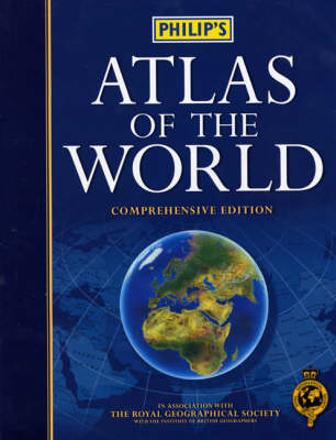
Philip's Atlas of the World
Philip's (Verlag)
978-0-540-08024-3 (ISBN)
- Titel erscheint in neuer Auflage
- Artikel merken
This atlas is aimed at use in the office, home or classroom. It is a combination of Philip's world mapping, and colourful thematic maps, charts and diagrams. This edition is based on the latest digital cartographic technology and includes urban area maps for 67 of the world's largest and most economically important cities, eight pages of statistics and a map highlighting regions of the world in the news in 2001. A 48-page introductory section explains key world themes such as the atmosphere, the Solar System, climate, geography, trade, agriculture, industry, population and health. The name index includes geographical features as well as towns and cities, with full latitude/longitude co-ordinates and letter-figure grid references.
1. NEW Map Features: National parks, game reserves and wildlife reserves, UNESCO Heritage sites in Africa, Oceania and Australasia. 2. NEW Indian States and the ratified Saudi Arabia/Yemen border are also featured. 3. NEW Island Maps: * Bermuda * Mauritius * New Providence Island, Bahama * Reunion * Azores * Whitsunday Island [Great Barrier Island] * Ascension Island * Jamaica * St Helena * Guadcloupe * Cape Verde Islands * Martinique * Mediterranean Islands * Puerto Rico * Ischia and Capri * Virgin Islands * Ionian Islands: Sporades, Cyclades * Barbados * Bali * Trinidad and Tobago * Ko Samui * St Lucia * Phuket * Antigua * Penang * St Martin * Lakshadweep Islands * Aruba * Andaman and Nicobar Islands inset * Curacao * Comoros inset * Galapagos Islands * Seychelles * Easter Island 4. Greater emphasis on transport: motorways and airports are clearer. 5. Greater emphasis on internal borders these have been made to stand out more due to the addition of national parks. 6. 'Introduction to World Geography': updated thematic maps. 7. 'Images of Earth': new explanatory captions. 8. Endpapers restyled - brighter and clearer. 9. Title verso restyled more emphasis on editorial board.
| Erscheint lt. Verlag | 17.9.2001 |
|---|---|
| Zusatzinfo | colour illustrations, all colour maps, graphs, diagrams, index |
| Verlagsort | London |
| Sprache | englisch |
| Maße | 291 x 380 mm |
| Gewicht | 3640 g |
| Themenwelt | Reisen ► Karten / Stadtpläne / Atlanten |
| ISBN-10 | 0-540-08024-1 / 0540080241 |
| ISBN-13 | 978-0-540-08024-3 / 9780540080243 |
| Zustand | Neuware |
| Informationen gemäß Produktsicherheitsverordnung (GPSR) | |
| Haben Sie eine Frage zum Produkt? |
aus dem Bereich


