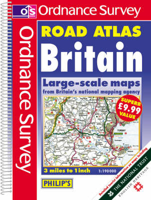
Ordnance Survey Road Atlas Britain
Seiten
2001
|
2nd Revised edition
Philip's OS Publications (Verlag)
978-0-540-07904-9 (ISBN)
Philip's OS Publications (Verlag)
978-0-540-07904-9 (ISBN)
- Titel erscheint in neuer Auflage
- Artikel merken
Zu diesem Artikel existiert eine Nachauflage
This atlas covers Britain at 3 miles to 1 inch. It has highlighted primary route destinations, and restricted motorway junctions, and road colouration. There are route-planning maps, tables of distances, tourist information and and index.
A brand new edition of Ordnance Survey Road Atlas Britain. This is the keenest-priced 3 miles to 1 inch compact atlas available on the market today. The atlas is in a convenient format (approximately A4) and contains Ordnance Survey's superior mapping at a full scale of 3 miles to 1 inch covering the whole of Britain. The mapping is clear, highly detailed and authoritative, making it both reliable for navigation and a true pleasure to use. No other compact atlas has more detailed mapping or a larger scale. The mapping has all the features you would expect from Ordnance Survey to allow easy route-finding, including highlighted primary route destinations, clear road coloration and restricted motorway junctions. There is a route-planning map, table of distances, and extensive tourist information, with National Trust and English Heritage properties distinguished. And of course, there is a comprehensive index.
A brand new edition of Ordnance Survey Road Atlas Britain. This is the keenest-priced 3 miles to 1 inch compact atlas available on the market today. The atlas is in a convenient format (approximately A4) and contains Ordnance Survey's superior mapping at a full scale of 3 miles to 1 inch covering the whole of Britain. The mapping is clear, highly detailed and authoritative, making it both reliable for navigation and a true pleasure to use. No other compact atlas has more detailed mapping or a larger scale. The mapping has all the features you would expect from Ordnance Survey to allow easy route-finding, including highlighted primary route destinations, clear road coloration and restricted motorway junctions. There is a route-planning map, table of distances, and extensive tourist information, with National Trust and English Heritage properties distinguished. And of course, there is a comprehensive index.
| Erscheint lt. Verlag | 12.12.2001 |
|---|---|
| Zusatzinfo | colour maps, index |
| Verlagsort | London |
| Sprache | englisch |
| Maße | 226 x 302 mm |
| Gewicht | 740 g |
| Themenwelt | Reisen ► Karten / Stadtpläne / Atlanten ► Europa |
| ISBN-10 | 0-540-07904-9 / 0540079049 |
| ISBN-13 | 978-0-540-07904-9 / 9780540079049 |
| Zustand | Neuware |
| Haben Sie eine Frage zum Produkt? |
Mehr entdecken
aus dem Bereich
aus dem Bereich
Buch | Spiralbindung (2024)
Freytag-Berndt und ARTARIA (Verlag)
CHF 41,85


