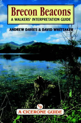
The Brecon Beacons
Cicerone Press (Verlag)
978-1-85284-182-9 (ISBN)
- Titel ist leider vergriffen;
keine Neuauflage - Artikel merken
The Brecon Beacons National Park has a considerable advantage for the average walker. Short, gentle, safe circular walks are numerous in this area. These vary greatly in character from low-level valley walks, including woodland and waterfalls, to combined valley and ridge walks. Relatively short distances need to be travelled by car as the walking areas are directly linked by roads. These factors make this an ideal area for individuals or families of any walking ability. The large number and wide choice of routes means that a walk can be selected to suit the weather and a wide variety of abilities and interests. The book describes 33 walks in detail with a commentary on every aspect of things seen along the way, so that in addition to its recreational role it has a fascinating educational role as well. The Brecon Beacons National Park has excellent road communication with south Wales, the Midlands and the south-east of England. All the walks described in this guidebook are covered by the Brecon Beacons National Park Central Area Outdoor Leisure Map 11.
The ideas for this book came from a realisation that many walkers in the Brecon Beacons wish to know more of the countryside they come to enjoy and explore. One solution is for them to follow one of the many guided walks organised by the Brecon Beacons National Park Authority. This guidebook has the added advantage of giving information on all aspects of the countryside, as though the walker were accompanied by several experts at the same time.
Introduction Educational role of the guide How to use the guide Finding a grid reference Choosing a suitable walk Table of difficulty and interest Information box directory Photographic hints Glossary of Welsh words and names ROUTE: Section A: North Eastern Valleys and Ridges CWM LLWCH Cwm Llwch/ Cefn Cwm Llwch Cwm Llwch Ridge Cwm Llwch Valley CWM SERE Cwm Sere/ Cefn Cwm Llwch Cwm Sere/ Bryn Teg Cwm Sere Ridge Cwm Sere Valley CWM CYNWYN Cwm Cynwyn/ Bryn Teg Cwm Cynwyn/ Cefn Cyff Cwm Cynwyn Ridge Cwm Cynwyn Calley CWM OERGWM Cwm Oergwm/ Cefn Cyff Cwm Oergwm/ Gist Wen Cwm Oergwm Ridge Cwm Oergwm Valley Section B: Eastern Valleys and Ridges Bryn Cwm Tarthwynni Circuit (with extension) Blaen- y- glyn/ Allt Forgan Blaen- y- glyn/ Craig y Fan Ddu Alternative via Cwar y Gigfran Low- Level Circuit of Waterfalls Torpantau Circuit Section C: South Western Valleys and Ridges Neuadd Horseshoe Cwm Llysiog/ Waun Wen (with extension) Cwm Crew/ Cefn Crew (with extension) Section D Fforest Fawr Craig Cerrig- gleisiad Fan Fawr Craig Cwm-du/ Fan Frynych Craig Cwm-du/ Fan Dringarth/ Fan Llia Fan Gyhirych/ Fan Nedd Section E: Waterfall Country Pontneddfechan Waterfalls Waterfall Walk Sgwd yr Eira Ystradfellte Waterfalls Afon Nedd/ Afon Mellte Appendix 1: Directions to the starts of walks Section A Section B Section C Section D Section E 2: Useful Addresses
| Reihe/Serie | Cicerone Guide |
|---|---|
| Zusatzinfo | Laminated Cover |
| Verlagsort | Kendal |
| Sprache | englisch |
| Maße | 116 x 172 mm |
| Themenwelt | Reiseführer ► Europa ► Großbritannien |
| ISBN-10 | 1-85284-182-6 / 1852841826 |
| ISBN-13 | 978-1-85284-182-9 / 9781852841829 |
| Zustand | Neuware |
| Haben Sie eine Frage zum Produkt? |
aus dem Bereich


