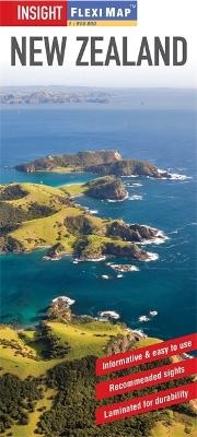
Insight Flexi Map: New Zealand
Seiten
2015
|
4th Revised edition
Insight Guides (Verlag)
978-1-78005-382-0 (ISBN)
Insight Guides (Verlag)
978-1-78005-382-0 (ISBN)
- Titel ist leider vergriffen;
keine Neuauflage - Artikel merken
Laminated, and tear-resistant, this title includes 5 separate maps, each map has its own index which has been categorised for ease of use. It includes a list - with descriptions and some photographs - of 18 recommended sights, divided by theme and linked to the mapping by numbered markers.
Flexi Map New Zealand is laminated, tear-resistant and includes 5 separate maps, each map has its own index which has been categorised for ease of use.
It includes a list - with descriptions and some photographs - of 18 recommended sights, divided by theme and linked to the mapping by numbered markers. There is also a handy information section with concise details on getting around, tourist offices, money, tipping, opening times, public holidays, telecommunications, emergency telephone numbers and climate.
North Island and South Island are shown on separate sides of this map at a scale of 1:1 750 000, (1cm = 17.5km). In addition to the road network, places of interest, such as prehistoric sites, beaches, National Parks and leisure facilities are identified by easy to recognise pictorial symbols; the comprehensive index includes a separate listing for these. The mapping also provides a detailed picture of the topography through the use of relief shading with mountain ranges named and some peak heights given.
Street plans of Christchurch, Auckland & Wellington are positioned adjacent to the relevant island, at a scale of 1:17 500 (1cm = 0.175km). One way streets, car parks and pedestrian zones are clearly shown. Many prominent public buildings, hotels and other places of interest are highlighted and listed in the extensive indexes.
| Erscheint lt. Verlag | 16.1.2015 |
|---|---|
| Reihe/Serie | Insight Guides Flexi Maps |
| Verlagsort | London |
| Sprache | englisch |
| Themenwelt | Reisen ► Karten / Stadtpläne / Atlanten ► Australien / Neuseeland / Ozeanien |
| ISBN-10 | 1-78005-382-7 / 1780053827 |
| ISBN-13 | 978-1-78005-382-0 / 9781780053820 |
| Zustand | Neuware |
| Informationen gemäß Produktsicherheitsverordnung (GPSR) | |
| Haben Sie eine Frage zum Produkt? |
Mehr entdecken
aus dem Bereich
aus dem Bereich
Inkl. Stadtpläne, Ortsverzeichnis und Reiseinformationen
Karte (gefalzt) (2024)
Hallwag (Verlag)
CHF 19,85
Karte/Kartografie (2023)
MAIRDUMONT (Verlag)
CHF 18,90
Karte (gefalzt) (2024)
Lonely Planet Global Limited (Verlag)
CHF 11,90


