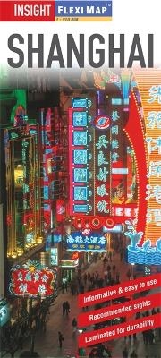
Insight Guides Flexi Map Shanghai
Seiten
2014
|
4th Revised edition
Insight Guides (Verlag)
978-1-78005-171-0 (ISBN)
Insight Guides (Verlag)
978-1-78005-171-0 (ISBN)
- Titel ist leider vergriffen;
keine Neuauflage - Artikel merken
Flexi Map Shanghai is laminated, tear-resistant comprising 3 separate maps featuring the city and its surroundings; each map has its own index which has been categorised for ease of use. This book includes a list - with descriptions and some photographs - of 37 recommended sights, divided by theme and linked to the mapping by numbered markers.
Flexi Map Shanghai is laminated, tear-resistant comprising 3 separate maps featuring the city and its surroundings; each map has its own index which has been categorised for ease of use.
It includes a list - with descriptions and some photographs - of 37 recommended sights, divided by theme and linked to the mapping by numbered markers. There is also a handy information section with concise details on getting around, tourist offices, money, tipping, opening times, public holidays, telecommunications, emergency telephone numbers and climate.
On one side is a street plan of the city's central districts at a scale of 1:17 500 (1cm = 0.18km). One way streets, car parks, train and metro routes are clearly shown, in addition a Metro map is located on the back cover for easy reference. Many prominent public buildings, hotels and other places of interest are highlighted and listed in the extensive index. Ferry routes across the Huangpu River are also marked. Place names are shown on this street plan in English and Chinese characters.
The reverse side includes a map of the Shanghai Area, including Pudong New Area, at a scale of 1:180 000 (1cm = 1.8km) together with a map of Eastern China at 1:3.5 million (1cm = 35km). Places of interest including UNESCO World Heritage Sites are clearly marked.
| Erscheint lt. Verlag | 1.12.2014 |
|---|---|
| Reihe/Serie | Insight Guides Flexi Maps |
| Verlagsort | London |
| Sprache | englisch |
| Themenwelt | Reisen ► Karten / Stadtpläne / Atlanten ► Asien |
| ISBN-10 | 1-78005-171-9 / 1780051719 |
| ISBN-13 | 978-1-78005-171-0 / 9781780051710 |
| Zustand | Neuware |
| Haben Sie eine Frage zum Produkt? |
Mehr entdecken
aus dem Bereich
aus dem Bereich
Karte (gefalzt) (2024)
Freytag-Berndt und ARTARIA (Verlag)
CHF 18,95
reiß- und wasserfest (world mapping project)
Karte (gefalzt) (2024)
Reise Know-How (Verlag)
CHF 17,90
Karte (gefalzt) (2024)
Reise Know-How (Verlag)
CHF 20,60


