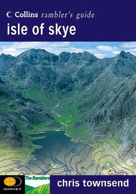
Isle of Skye
Seiten
2001
|
New edition
Collins (Verlag)
978-0-00-220200-8 (ISBN)
Collins (Verlag)
978-0-00-220200-8 (ISBN)
- Titel ist leider vergriffen;
keine Neuauflage - Artikel merken
Zu diesem Artikel existiert eine Nachauflage
Produced in association with the Rambler’s Association and Harvey’s Maps, this brand new series covers some of the most popular walking areas in Britain and Ireland, combining detailed route descriptions with information on the local history and wildlife.
This famous corner of the Scottish Highlands and Islands is home to a spectacular variety of mountain landscapes and dramatic coastlines. There is also a wealth of fascinating places to explore: caves and sea stacks, headlands and arches, waterfalls and castles.
The introduction gives information about the topography, geology and history of the area, and describes the flora and fauna inhabiting it.
•The main section of the book comprises 30 walks, suitable for all abilities, from young children to experienced walkers. Each walk has a key illustrating principal features, such as level of difficulty and type of terrain, a route profile indicating altitude and distances, as well as a fact file summarising useful information, such as start and finish points, duration, safety advice and points of interest.
•Illustrated with colour maps from leading authority, Harveys, each walk is then described in detail with clear, easy-to-follow instructions. The text gives the history of the main landmarks along the way and information about the natural history of the area, and is accompanied by stunning colour photographs.
Chris Townsend is one of the country’s best known walkers. Formerly the editor of an outdoor leisure magazine, he now works as a freelance writer and walking tour guide.
| Erscheint lt. Verlag | 6.8.2001 |
|---|---|
| Reihe/Serie | Collins Rambler’s Guide |
| Zusatzinfo | 130 col illus, (30 colour maps, 30 walk profiles), Index |
| Verlagsort | London |
| Sprache | englisch |
| Maße | 148 x 210 mm |
| Gewicht | 428 g |
| Themenwelt | Sachbuch/Ratgeber ► Sport |
| Reiseführer ► Europa ► Großbritannien | |
| Reiseführer ► Europa ► Schottland | |
| ISBN-10 | 0-00-220200-X / 000220200X |
| ISBN-13 | 978-0-00-220200-8 / 9780002202008 |
| Zustand | Neuware |
| Haben Sie eine Frage zum Produkt? |
Mehr entdecken
aus dem Bereich
aus dem Bereich
individuell reisen mit vielen praktischen Tipps
Buch | Softcover (2024)
Michael Müller (Verlag)
CHF 43,90
Reiseführer mit Stadtplan, 4 Spaziergängen und kostenloser Web-App
Buch | Softcover (2023)
Reise Know-How (Verlag)
CHF 22,90


