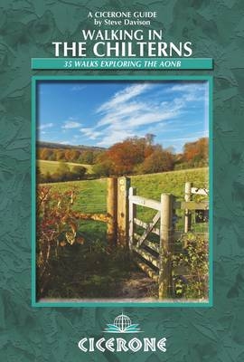
Walking in the Chilterns
Cicerone Press (Verlag)
978-1-85284-700-5 (ISBN)
- Titel ist leider vergriffen;
keine Neuauflage - Artikel merken
This guidebook describes 35 varied day walks in the Chilterns Area of Outstanding Natural Beauty in southern England. The routes range from 4 to 12 miles and cover fairly low-level terrain, and although some have several, sometimes steep, climbs and descents, they should be suitable for most walkers. The walks take you on a journey through this classic Chiltern landscape that has been shaped by human activity for thousands of years, visiting interesting historic sites, colourful gardens and picture-postcard villages with thatched cottages, fascinating churches and cosy pubs. Step by step route directions include lots of information about all these sites along the way and are illustrated with clear OS mapping and vibrant photographs. The Chiltern Hills follow a line of chalk from the River Thames at Goring up to the Barton Hills just west of Hitchin, through Oxfordshire, Buckinghamshire, Hertfordshire and Bedfordshire, with great views from the north west edge and, on the south east side, a more intimate undulating landscape of rounded hills and valleys, covered in a mix of broadleaved woodland and open farmland.
Steve Davison is a freelance writer and photographer who has lived in Berkshire for over 25 years. He has written several guidebooks as well as articles for magazines and newspapers, specialising in hill walking and UK and European travel. A keen hill walker, Steve holds a Mountain Leader Certificate and is a member of the Outdoor Writers and Photographers Guild.
Map key
Overview map
Introduction
Geology
Plants and wildlife
Brief history
Where to stay
Getting to and around the Chilterns
Food and drink
Walking in the Chilterns
Maps
Waymarking, access and rights of way
Using this guide
1 North of Luton
Walk 1 Harlington and Sharpenhoe Clappers
Walk 2 Barton-le-Clay, Hexton and Barton Hills
Walk 3 Pirton and Pegsdon Hills
2 Dunstable to Berkhamsted
Walk 4 Whipsnade, Studham and the Dunstable Downs
Walk 5 Ivinghoe Beacon, Ivinghoe and Pitstone
Walk 6 Grand Union Canal, Pitstone Hill and Aldbury
Walk 7 Grand Union Canal and Tring Park
Walk 8 Great Gaddesden
Walk 9 Berkhamsted, Nettleden and Little Gaddesden
3 Wendover to Stokenchurch
Walk 10 Cholesbury and Hawridge
Walk 11 Wendover and The Lee
Walk 12 Wendover, Ellesborough, Chequers and Coombe Hill
Walk 13 Whiteleaf Hill and Great Kimble
Walk 14 Bledlow and Radnage
Walk 15 Lacey Green, Speen and Bryant's Bottom
Walk 16 Great Hampden
Walk 17 Great Missenden and Chartridge
4 Amersham to High Wycombe
Walk 18 Chenies, Latimer and the River Chess
Walk 19 Little Missenden, Penn Wood and Penn Street
Walk 20 Hughenden, Bradenham and West Wycombe
Walk 21 Penn and Coleshill
5 Watlington and Nettlebed
Walk 22 Christmas Common and Watlington Hill
Walk 23 Turville, Skirmett and Fingest
Walk 24 Pishill and Stonor
Walk 25 Pishill, Cookley Green and Russell's Water
Walk 26 Ewelme and Swyncombe
Walk 27 Checkendon and Stoke Row
Walk 28 Hailey and Grim's Ditch
Walk 29 Nettlebed and Nuffield
Walk 30 Greys Green, Rotherfield Greys and Greys Court
6 Along the Thames
Walk 31 Hambleden, Medmenham and the River Thames
Walk 32 Henley-on-Thames and Middle Assendon
Walk 33 South and North Stoke and Grim's Ditch
Walk 34 Goring-on-Thames and Cray's Pond
Walk 35 Whitchurch Hill and Mapledurham
Appendix A Route summary table
Appendix B Useful contacts
| Erscheint lt. Verlag | 6.6.2014 |
|---|---|
| Zusatzinfo | 120 colour photos and 40 maps |
| Verlagsort | Kendal |
| Sprache | englisch |
| Maße | 116 x 172 mm |
| Gewicht | 250 g |
| Themenwelt | Sachbuch/Ratgeber ► Sport |
| Reiseführer ► Europa ► Großbritannien | |
| ISBN-10 | 1-85284-700-X / 185284700X |
| ISBN-13 | 978-1-85284-700-5 / 9781852847005 |
| Zustand | Neuware |
| Haben Sie eine Frage zum Produkt? |
aus dem Bereich


