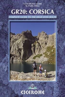
The GR20 Corsica
Cicerone Press (Verlag)
978-1-85284-635-0 (ISBN)
- Titel ist leider vergriffen;
keine Neuauflage - Artikel merken
This guidebook describes the 'classic' route to walking the GR20 on Corsica, along with high- and low-level alternatives, plus extra mountain climbs. The guide explains exactly what is involved in following the GR20, including what walkers need to carry and how difficult the route is in places. Detailed route descriptions give all the information required and there are stunning photographs to inspire you along the way. Corsica is a mountainous island in the Mediterranean and its GR20 is one of the greatest adventure treks in Europe. It is reputed to be the toughest waymarked trail of all the GR routes. An ambitious route for fit and agile walkers, it covers 190km in about two weeks as it makes a complete traverse through the high mountains, negotiating magnificent mountain terrain and following the rocky central spine of Corsica across the whole length of the island. Some sections of the route are on walking trails, others are on bare rock where some hands-on scrambling is necessary. Facilities are limited to a dozen mountain refuges and a mere handful of hotels or gîtes.
Paddy Dillon is a prolific outdoor writer with numerous books to his name. He writes for outdoor magazines and other publications, as well as for tourism groups and other organisations. He lives on the fringe of the Lake District, and has walked and written about every county of Great Britain as well as Nepal, Tibet and the Canadian Rockies.
Map Key
General Map of Corsica
Introduction
Geology
Brief History
Travel to Corsica
Travel Around Corsica
How to Reach the GR20
When to Walk the GR20
How to Walk the GR20
How to Use this guide
Maps of the GR20
Mountain Weather
Path Conditions
Mountain Rescue
Kit Check
Services on the GR20
Food, Drink and Fuel
Language
Currency
Flowers and Wildlife
Advice in a Nutshell
Points to Bear in Mind
Food Supplies and Services
Calenzana and the Start of the GR20
Calenzana
Stage 1A Calenzana to Refuge d'Ortu di u Piobbu (high-level)
Stage 1B Calenzana to Refuge d'Ortu di u Piobbu (low-level)
Ascent of Monte Corona from Refuge d'Ortu di u Piobbu
Stage 2A Refuge d'Ortu di u Piobbu to Refuge de Carozzu (high-level)
Stage 2B Refuge d'Ortu di u Piobbu to Refuge de Carozzu (low-level)
Stage 3 Refuge de Carozzu to Haut Asco
Ascent of Monte Cinto from Haut Asco
Stage 4 Haut Asco to Auberge U Vallone
Link from Auberge U Vallone to Albertacce
Stage 5 Auberge U Vallone to Hôtel Castel di Vergio
Ascent of Paglia Orba from Refuge de Ciottulu di I Mori
Stage 6 Hôtel Castel di Vergio to Refuge de Manganu
Link from Refuge de Manganu to Soccia
Stage 7 Refuge de Manganu to Refuge de Petra Piana
Link from Bocca a Soglia to Bergeries de Grotelle
Ascent of Monte Ritondu from Refuge de Petra Piana
Stage 8A Refuge de Petra Piana to Refuge de l'Onda (low-level)
Stage 8B Refuge de Petra Piana to Refuge de l'Onda (high-level)
Link from Bergeries de Tolla to Tattone
Stage 9A Refuge de l'Onda to Vizzavona (low-level)
Stage 9B Refuge de l'Onda to Vizzavona (high-level)
Vizzavona and the Midpoint of the GR20
Vizzavona
Stage 10 Vizzavona to Bergeries d' E Capanelle
Link from Hôtel Monte d'Oro to Bocca Palmento
Stage 11A Bergeries d' E Capanelle to Bocca di Verdi (low-level)
Stage 11B Bergeries d' E Capanelle to Bocca di Verdi (high-level)
Stage 12 Bocca di Verdi to Refuge d'Usciolu
Link from Refuge d'Usciolu to Cozzano
Stage 13 Refuge d'Usciolu to Refuge de Matalza
Link from Tignosellu to Zicavo
Link from Zicavo to Refuge de Matalza
Stage 14 Refuge de Matalza to Refuge d'Asinau
Alt Stage 13/14 Refuge d'Usciolu to Refuge d'Asinau (direct)
Stage 15A Refuge d'Asinau to Village de Bavella (low-level)
Stage 15B Refuge d'Asinau to Village de Bavella (high-level)
Stage 16 Village de Bavella to Conca
Conca and the End of the GR20
Appendix 1 Summary of GR20 Walking Times and Facilities
Appendix 2 Reverse Route Summary
Appendix 3 Basic Language Notes for the GR20
| Zusatzinfo | Over 80 colour photos and 70 maps and profiles |
|---|---|
| Verlagsort | Kendal |
| Sprache | englisch |
| Maße | 116 x 172 mm |
| Gewicht | 300 g |
| Themenwelt | Sachbuch/Ratgeber ► Sport |
| Reiseführer ► Europa ► Frankreich | |
| ISBN-10 | 1-85284-635-6 / 1852846356 |
| ISBN-13 | 978-1-85284-635-0 / 9781852846350 |
| Zustand | Neuware |
| Haben Sie eine Frage zum Produkt? |
aus dem Bereich


