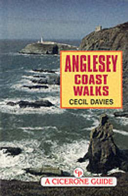
Anglesey Coast Walks
Cicerone Press (Verlag)
978-1-85284-266-6 (ISBN)
- Titel ist leider vergriffen;
keine Neuauflage - Artikel merken
This is a guide to the coastal walks in Anglesey, the island lying across the Menai Straits in north-west Wales. The author guides you around the island in smallish stages and describes the distinctive character of its geology, geography and history: the east coast with its long beaches and estuaries and the Penmon peninsula; the west with its varied coastline and Holyhead Island; the north with its spectacular cliffs and coves comparable with those of west Cornwall. Interesting land features and fascinating stories of the people of this proud Welsh isle are highlights of the guide. Most of the walks are only a few miles long across undemanding terrain and make an easy day's outing. Several can be joined together for a longer day, or long-distance walkers can link them all together for a grand tour of the island.
INTRODUCTION THE NORTH COAST Point Lynas to Amlwch Port Parys Mountain (Mynydd Trysglwyn) Amlwch to Bull Bay (Porth Llechog) Bull Bay (Porth Llechog) to Porth Wen Porth Wen to Cemaes Cemaes to Cemlyn Cemlyn to Hen Borth Hen Borth to Carmel Head THE WEST COAST Carmel Head to Porth Swtan Porth Swtan to the Stanley Embankment Stanley Embankment to Four Mile Bridge (Pont Rhyd y Bont) Four Mile Bridge to Rhosneigr Rhosneigr to Porth Trecastell Porth Trecastell to Porth Cwyfan Porth Cwyfan to Aberffraw Aberffraw to Malltraeth Malltraeth Malltraeth to Abermenai Point Newborough Holy Island; Ynys Gybi Stanley Embankment to Holyhead (Caer Gybi) Holyhead to Holyhead Mountain and South Stack South Stack to Trearddur Bay Treaddur Bay to Rhoscolyn Walks near Rhoscolyn Rhoscolyn and Four Mile Bridge THE SOUTH COAST Newborough to the Mermaid Inn Mermaid Inn to Moel- y- don Moel- y- don to Beaumaris Beaumaris to Penmon Penmon THE EAST COAST Penmon to Llanddona Beach Llanddona Beach to Red Wharf Bay Red Wharf Bay to Moelfre Moelfre to Lligwy Lligwy to Dulas Dulas to Point Lynas "The book, with its clear maps and tips of Welsh pronunciation, slips readily into a pocket." MC TGO, Nov 1998
| Erscheint lt. Verlag | 1.9.1998 |
|---|---|
| Reihe/Serie | Cicerone Guide |
| Zusatzinfo | Laminated Cover |
| Verlagsort | Kendal |
| Sprache | englisch |
| Maße | 116 x 172 mm |
| Themenwelt | Sachbuch/Ratgeber ► Sport |
| Reiseführer ► Europa ► Großbritannien | |
| ISBN-10 | 1-85284-266-0 / 1852842660 |
| ISBN-13 | 978-1-85284-266-6 / 9781852842666 |
| Zustand | Neuware |
| Haben Sie eine Frage zum Produkt? |
aus dem Bereich


