


Reader's Digest World Atlas
Seiten
2014
Reader's Digest (Australia) Pty Ltd (Verlag)
978-1-922083-68-5 (ISBN)
Reader's Digest (Australia) Pty Ltd (Verlag)
978-1-922083-68-5 (ISBN)
- Titel ist leider vergriffen;
keine Neuauflage - Artikel merken
An atlas is more than just a series of maps. It is a comprehensive guide to the world in which we live, and provides insights into the innumerable unique features of our world - from politics to vegetation zones, from population distribution to heritage sites. Continuing a 52-year tradition as one of the leading producers of atlases and expertly edited knowledge about our planet, this stunning new edition of the Reader's Digest World Atlas is an indispensable and fascinating reference. In an ever-changing world, we all need a reliable resource to understand where news is happening, where the Earth's natural resources are found, where people live and work, what different landscapes look like and what forces shape our world. With this handsome atlas in your hands, you'll discover so many new things. And you'll do so faster, and more enjoyably, and with a level of complete trust that only Reader's Digest can provide. -224 maps created using state-of-the-art digital mapping techniques. -Vibrant 3-D landscape modelling combined with a large-page format offers an unparalleled view of our planet. -Updated political maps and a new section of maps on the Earth's vegetation zones.
-Thematic features explain the farthest reaches of space; the formation of planet Earth; the world's oceans; and the workings of the weather. -A feature on the art of mapmaking explains the ways in which projections of the spherical surface of the Earth are represented on a flat surface and how cartographers layer data and integrate those layers to create maps. -Comprehensive index of more than 100,000 entries helps you to quickly find the largest cities, the smallest villages, the biggest deserts, the highest mountains. -An A to Z gazetteer of all the world's 242 countries and autonomous territories features population figures, official languages, flags, capital cities and major resources and industries. -Stunning photographs provide an insight into the landscapes, coastlines, waterways and cityscapes of countries around the world.
-Thematic features explain the farthest reaches of space; the formation of planet Earth; the world's oceans; and the workings of the weather. -A feature on the art of mapmaking explains the ways in which projections of the spherical surface of the Earth are represented on a flat surface and how cartographers layer data and integrate those layers to create maps. -Comprehensive index of more than 100,000 entries helps you to quickly find the largest cities, the smallest villages, the biggest deserts, the highest mountains. -An A to Z gazetteer of all the world's 242 countries and autonomous territories features population figures, official languages, flags, capital cities and major resources and industries. -Stunning photographs provide an insight into the landscapes, coastlines, waterways and cityscapes of countries around the world.
| Erscheint lt. Verlag | 1.1.2014 |
|---|---|
| Verlagsort | Surry Hills |
| Sprache | englisch |
| Maße | 267 x 358 mm |
| Themenwelt | Reisen ► Karten / Stadtpläne / Atlanten ► Welt / Arktis / Antarktis |
| ISBN-10 | 1-922083-68-2 / 1922083682 |
| ISBN-13 | 978-1-922083-68-5 / 9781922083685 |
| Zustand | Neuware |
| Haben Sie eine Frage zum Produkt? |
Mehr entdecken
aus dem Bereich

aus dem Bereich
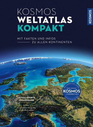
mit Fakten und Infos zu allen Kontinenten
Buch | Hardcover (2024)
Kosmos Kartografie in der Franckh-Kosmos Verlags-GmbH & Co. …
CHF 35,90