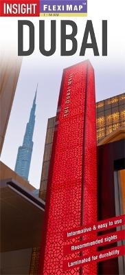
Insight Flexi Map: Dubai
Seiten
2013
|
2nd Revised edition
Insight Guides (Verlag)
978-1-78005-572-5 (ISBN)
Insight Guides (Verlag)
978-1-78005-572-5 (ISBN)
- Titel ist leider vergriffen;
keine Neuauflage - Artikel merken
Includes 3 maps, each accompanied by separate indexes that are categorized for ease of use. This title gives a list - with descriptions and some photographs - of 24 recommended sights, divided by theme and linked to the mapping by numbered markers. It offers information section with concise details on getting around, tourist offices, and money.
Flexi Map Dubai is a laminated, tear-resistant map which includes 3 maps, each accompanied by separate indexes that are categorized for ease of use. The main map depicts the Dubai area at a scale of 1:100 000, from Sharjah to the Dubai Waterfront. The Jumeirah Palm and the other development areas are shown. Main roads are named, and numbered where applicable, and the Metro system is clearly marked.
Central Dubai is shown at a scale of 1:15 000 and identifies places of interest, public buildings, selected hotels, parks and shopping areas. Both main and minor roads are named, car parks and one-way systems are clearly shown.
An overview map of the United Arab Emirates, at a scale of 1:1.5 million, shows the road network with intermediate driving distances. Points of interest are shown as well as other features, such as, water springs, coral reefs, shipwrecks and offshore oilfields.
Flexi Map Dubai also gives a list - with descriptions and some photographs - of 24 recommended sights, divided by theme and linked to the mapping by numbered markers. There is also a handy information section with concise details on getting around, tourist offices, money, tipping, opening times, public holidays, telecommunications, emergency telephone numbers and climate.
| Erscheint lt. Verlag | 2.4.2013 |
|---|---|
| Reihe/Serie | Insight Guides Flexi Maps |
| Verlagsort | London |
| Sprache | englisch |
| Themenwelt | Reisen ► Karten / Stadtpläne / Atlanten ► Naher Osten |
| Reisen ► Karten / Stadtpläne / Atlanten ► Asien | |
| ISBN-10 | 1-78005-572-2 / 1780055722 |
| ISBN-13 | 978-1-78005-572-5 / 9781780055725 |
| Zustand | Neuware |
| Haben Sie eine Frage zum Produkt? |
Mehr entdecken
aus dem Bereich
aus dem Bereich
reiß- und wasserfest (world mapping project)
Karte (gefalzt) (2024)
Reise Know-How (Verlag)
CHF 16,90
Karte (gefalzt) (2024)
Freytag-Berndt und ARTARIA (Verlag)
CHF 21,90
Karte (gefalzt) (2023)
Reise Know-How (Verlag)
CHF 16,90


