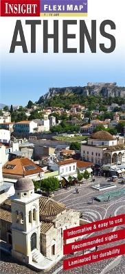
Insight Flexi Map: Athens
Seiten
2013
|
4th Revised edition
Insight Guides (Verlag)
978-1-78005-456-8 (ISBN)
Insight Guides (Verlag)
978-1-78005-456-8 (ISBN)
- Titel erscheint in neuer Auflage
- Artikel merken
Zu diesem Artikel existiert eine Nachauflage
Fleximap Athens is a laminated, tear-resistant map which includes 3 maps, each accompanied by separate indexes, categorized for ease of use. In this title, the Athens environs is shown at 1:120 000 and a road map of Attica, which includes many famous archaeological sites, is shown at 1:850 000.
Fleximap Athens is a laminated, tear-resistant map which includes 3 maps, each accompanied by separate indexes, categorized for ease of use. The main map depicts Athens at a scale of 1:11 500 and clearly identifies metro stations, places of interest, public buildings and selected hotels. The Athens environs is shown at 1:120 000 and a road map of Attica, which includes many famous archaeological sites, is shown at 1:850 000. In addition, there is a plan of the metro system, which is located on the back cover for easy access, and a plan of the Acropolis.
Fleximap Athens also gives a list - with descriptions and some photographs - of 26 recommended sights, divided by theme and linked to the mapping by numbered markers. There is also a handy information section with concise details on getting around, tourist offices, money, tipping, opening times, public holidays, telecommunications, emergency telephone numbers and climate.
| Erscheint lt. Verlag | 1.3.2013 |
|---|---|
| Reihe/Serie | Insight Guides Flexi Maps |
| Verlagsort | London |
| Sprache | englisch |
| Themenwelt | Reisen ► Karten / Stadtpläne / Atlanten ► Europa |
| ISBN-10 | 1-78005-456-4 / 1780054564 |
| ISBN-13 | 978-1-78005-456-8 / 9781780054568 |
| Zustand | Neuware |
| Haben Sie eine Frage zum Produkt? |
Mehr entdecken
aus dem Bereich
aus dem Bereich
Straßen- und Freizeitkarte 1:250.000
Karte (gefalzt) (2023)
Freytag-Berndt und ARTARIA (Verlag)
CHF 19,90
Karte (gefalzt) (2023)
Freytag-Berndt und ARTARIA (Verlag)
CHF 19,90
Östersund
Karte (gefalzt) (2023)
Freytag-Berndt und ARTARIA (Verlag)
CHF 21,90


