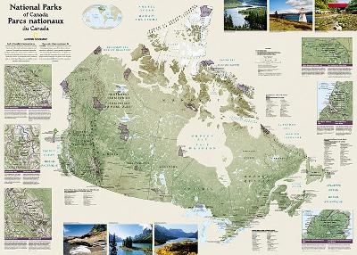
Canada National Parks, folded and polybagged
Wall Maps History & Nature
Seiten
2012
|
2012nd ed.
National Geographic Maps (Verlag)
978-1-59775-504-7 (ISBN)
National Geographic Maps (Verlag)
978-1-59775-504-7 (ISBN)
- Keine Verlagsinformationen verfügbar
- Artikel merken
National Geographic Wall Maps offer a special glimpse into current and historical events, and they inform about the world and environment. Offered in a variety of styles and formats, these maps are excellent reference tools and a perfect addition to any home, business or school. There are a variety of map options to choose from, including the world, continents, countries and regions, the United States, history, nature and space.
| Erscheint lt. Verlag | 2.8.2012 |
|---|---|
| Verlagsort | Evergreen |
| Sprache | englisch |
| Maße | 192 x 240 mm |
| Gewicht | 99 g |
| Themenwelt | Reisen ► Karten / Stadtpläne / Atlanten ► Welt / Arktis / Antarktis |
| ISBN-10 | 1-59775-504-4 / 1597755044 |
| ISBN-13 | 978-1-59775-504-7 / 9781597755047 |
| Zustand | Neuware |
| Haben Sie eine Frage zum Produkt? |
Mehr entdecken
aus dem Bereich
aus dem Bereich
1:30 Mio. mit Posterleisten, mit Oberflächenlaminat
Karte (gerollt) (2023)
INTERKART Landkarten & Globen (Verlag)
CHF 32,90


