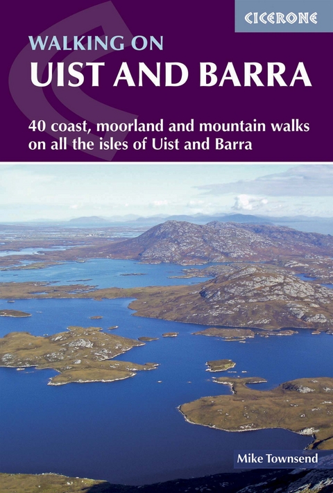
Walking on Uist and Barra
Cicerone Press (Verlag)
978-1-85284-660-2 (ISBN)
- Titel ist leider vergriffen;
keine Neuauflage - Artikel merken
This guide offers 40 walking routes on the Uists and Barra - a unique 100km cluster of islands in Scotland's Outer Hebrides. The walks are varied and graded, from short, flat beach walks beside crystal clear waters to long excursions across wild mountainous terrain, the routes visit all the major islands from Berneray to Vatersay but also those smaller and offshore such as Eriskay and Mingulay. Routes are described in four sections, by area, and illustrated with vivid colour photographs and OS mapping. Walking across these landscapes, especially the hill country, gives a sense of remoteness and peaceful solitude that cannot be found in the mainland's National Parks or on the Munros busy with peak baggers. Despite a relatively narrow area, Uist and Barra's diverse islands offer a contrasting walking terrain and many ancient historic sites such as chambered cairns and standing stones as well as lots of local wildlife. Upland areas are home to red deer and golden and white-tailed eagles, while along the coast grey seals are common and thousands of birds set up their breeding grounds in the machair. Daily flights between Glasgow and Benbecula as well as the ferry network mean that all of the islands are readily accessible.
Mike Townsend's love of hills and wild places began when, as a teenager, he spent walking holidays in the Lake District and Snowdonia. He moved to the Outer Hebrides in 1980 to work as a Geography teacher on Barra, and relocated to Uist in 1988. He has spent prolonged periods exploring the hills and coastlines of the islands, particularly the more remote and unfrequented areas.
Regional overview map
Map showing areas covered by each chapter
Introduction
Geology and geomorphology
History
Plants and wildlife
Transport
Accommodation and facilities
Safety
Access
Using the guide
1 North Uist
Walk 1.1 Berneray (Beàrnaraigh)
Walk 1.2 Udal
Walk 1.3 Crògearraidh Mòr
Walk 1.4 Lochportain
Walk 1.5 Lì a Tuath and Lì a Deas
Walk 1.6 Langais
Walk 1.7 Burabhal
Eabhal
Walk 1.8 Eabhal from Loch Euphort
Walk 1.9 Eabhal from Cladach Chairinis
Walk 1.10 Grimsay (Griomasaigh)
Walk 1.11 Scolpaig
Walk 1.12 Hogha Gearraidh and Hosta
Walk 1.13 Balranald Nature Reserve
Walk 1.14 Baleshare (Baile Sear)
2 Benbecula
Walk 2.1 Borgh
Walk 2.2 Culla Bay
Walk 2.3 Ròisinis
Walk 2.4 Ruabhal
3 South Uist
Walk 3.1 Loch Sgioport
Walk 3.2 Uisinis lighthouse and Nicolson's Leap
Walk 3.3 The Northern Corries of Thacla
Walk 3.4 The Three Peaks
Beinn Mhòr
Walk 3.5 Beinn Mhòr from Sniseabhal
Walk 3.6 Beinn Mhòr from Taobh a Tuath Loch Aineort
Walk 3.7 Taobh a Tuath Loch Aineort
Walk 3.8 Stulaigh
Walk 3.9 Gleann Dail bho Dheas
Walk 3.10 Eriskay (Eirisgeigh)
Machair Way
Walk 3.11 Tobha Mòr
Walk 3.12 Aisgernis/Cladh Hàlainn
4 Barra
Walk 4.1 Barra's northern peninsular
Walk 4.2 Cliaid
Walk 4.3 Allathasdal
Barra's central hills
Walk 4.4 The Barra Watershed
Walk 4.5 Barra's highest hills
Walk 4.6 Central Barra
Walk 4.7 Dùn Bàn
Walk 4.8 Dùn Bàn and Beinn Tangabhal
Walk 4.9 Vatersay (Bhatarsaigh)
Walk 4.10 Mingulay (Miùghlaigh)
Appendix A Glossary of Gaelic and Norse terms
Appendix B Route summary table
Appendix C Further reading
Appendix D Useful information
| Erscheint lt. Verlag | 8.11.2018 |
|---|---|
| Reihe/Serie | Cicerone guidebooks |
| Zusatzinfo | 90 colour photos and 40 OS map extracts |
| Verlagsort | Kendal |
| Sprache | englisch |
| Maße | 116 x 172 mm |
| Gewicht | 210 g |
| Themenwelt | Sachbuch/Ratgeber ► Sport |
| Reiseführer ► Europa ► Großbritannien | |
| Reiseführer ► Europa ► Schottland | |
| Reisen ► Sport- / Aktivreisen ► Europa | |
| ISBN-10 | 1-85284-660-7 / 1852846607 |
| ISBN-13 | 978-1-85284-660-2 / 9781852846602 |
| Zustand | Neuware |
| Haben Sie eine Frage zum Produkt? |
aus dem Bereich


