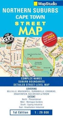
Street map Northern suburbs
Seiten
2011
Map Studio (Verlag)
978-1-77026-319-2 (ISBN)
Map Studio (Verlag)
978-1-77026-319-2 (ISBN)
- Titel nicht im Sortiment
- Artikel merken
This detailed new map of the northern suburbs of Cape Town indicates suburb names and boundaries. Map detail includes freeways, exits, main and minor roads with road names, industrial areas, major shopping complexes, places of interest, schools, hospitals and clinics, fire stations, parks, reserves and sports fields. Coverage shows to the north extent - Vissershok Road, to the west extent - N7 Highway, to the east extent - Kraaifontein and to the south extent - Epping/Parow industrial areas.
| Erscheint lt. Verlag | 11.10.2011 |
|---|---|
| Verlagsort | Cape Town |
| Sprache | englisch |
| Maße | 690 x 1000 mm |
| Gewicht | 60 g |
| Themenwelt | Reisen ► Karten / Stadtpläne / Atlanten ► Afrika |
| ISBN-10 | 1-77026-319-5 / 1770263195 |
| ISBN-13 | 978-1-77026-319-2 / 9781770263192 |
| Zustand | Neuware |
| Haben Sie eine Frage zum Produkt? |
Mehr entdecken
aus dem Bereich
aus dem Bereich
Karte (gefalzt) (2024)
Freytag-Berndt und ARTARIA (Verlag)
CHF 18,95
Karte (gefalzt) (2023)
Freytag-Berndt und ARTARIA (Verlag)
CHF 21,90
reiß- und wasserfest (world mapping project)
Karte (gefalzt) (2024)
Reise Know-How (Verlag)
CHF 17,90


