London Bus/underground PopOut Map
Seiten
2011
|
New edition
Footprint PopOut Maps (Verlag)
978-1-84587-858-0 (ISBN)
Footprint PopOut Maps (Verlag)
978-1-84587-858-0 (ISBN)
- Titel erscheint in neuer Auflage
- Artikel merken
Zu diesem Artikel existiert eine Nachauflage
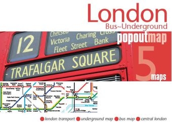
Explore London with ease with this handy, pop-up transport map. This genuinely pocket-sized city map includes 2 PopOut maps featuring the bus routes and the whole underground.
The ultimate pocket map of London's bus and underground transport system! Explore London with ease with the help of this genuinely pocket-sized, pop-up map. Small in size yet big on detail, this compact, dependable map will ensure you don't miss a thing. * Includes 2 PopOut maps - a detailed bus map of central London and the whole Underground network shown * Handy, self-folding, tourist map is small enough to fit in your pocket yet offers extensive coverage of the city in an easy-to-use format * Thorough place index is also featured and cross-referenced to the Underground map and the bus map so you can easily find your destination * Key places of interest are listed offering you advice on the best things to see
The ultimate pocket map of London's bus and underground transport system! Explore London with ease with the help of this genuinely pocket-sized, pop-up map. Small in size yet big on detail, this compact, dependable map will ensure you don't miss a thing. * Includes 2 PopOut maps - a detailed bus map of central London and the whole Underground network shown * Handy, self-folding, tourist map is small enough to fit in your pocket yet offers extensive coverage of the city in an easy-to-use format * Thorough place index is also featured and cross-referenced to the Underground map and the bus map so you can easily find your destination * Key places of interest are listed offering you advice on the best things to see
1) London Transport 2) Underground Map 3) Bus Map 4) Central London
| Erscheint lt. Verlag | 16.9.2011 |
|---|---|
| Reihe/Serie | Popout Maps |
| Sprache | englisch |
| Maße | 130 x 95 mm |
| Themenwelt | Reisen ► Karten / Stadtpläne / Atlanten ► Europa |
| ISBN-10 | 1-84587-858-2 / 1845878582 |
| ISBN-13 | 978-1-84587-858-0 / 9781845878580 |
| Zustand | Neuware |
| Haben Sie eine Frage zum Produkt? |
Mehr entdecken
aus dem Bereich
aus dem Bereich
Straßen- und Freizeitkarte 1:250.000
Karte (gefalzt) (2023)
Freytag-Berndt und ARTARIA (Verlag)
CHF 19,90
Karte (gefalzt) (2023)
Freytag-Berndt und ARTARIA (Verlag)
CHF 19,90
Östersund
Karte (gefalzt) (2023)
Freytag-Berndt und ARTARIA (Verlag)
CHF 21,90


