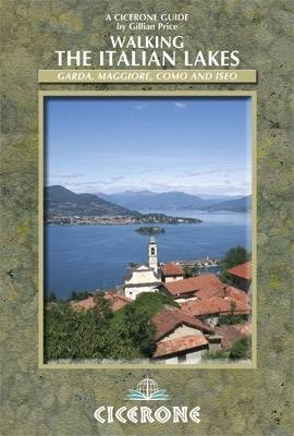
Walking the Italian Lakes
Cicerone Press (Verlag)
978-1-85284-657-2 (ISBN)
- Titel ist leider vergriffen;
keine Neuauflage - Artikel merken
This guidebook describes 48 day walks, on little-known but well waymarked paths, in the picturesque Lakes region of Northern Italy. The routes range from 2 to 13 miles in length. There is something for everyone, from easy leisurely strolls for first-time walkers to strenuous climbs for those with experience up panoramic peaks. The well-marked straightforward routes can easily be fitted into the space of a day, and every one of them can be accessed by the excellent local public transport network - ferry, train, bus, cable car, chair lift or funicular. All routes are illustrated with the author's own clear maps and inspirational colour photographs with full information provided about accommodation and public transport options around each of the four lakes of Maggiore, Como, Iseo and Garda for easy planning.
Gillian Price is a leading English-language authority on exploring Italy. She has trekked throughout Asia and the Himalayas but now lives in Venice, only two hours from the Dolomite mountains. She is an active member of both the Italian Alpine Club and the Outdoor Writers and Photographers Guild.
Map Key
Overview Map
Introduction
Plants and flowers
Wildlife
Getting there
Local transport
Information
When to go
Accommodation
Food and drink
What to take
Maps
Dos and don'ts
Emergencies
Using this guide
Lago Maggiore
Walk 1 Stresa to Belgirate
Walk 2 From the Mottarone to Baveno
Walk 3 Monte Orfano and Lago di Mergozzo
Walk 4 Cavandone on Monterosso
Walk 5 Ghiffa Sanctuary Loop
Walk 6 Villages above Cannero
Walk 7 The Cannero-Cannobio Traverse
Walk 8 Monte Carza
Walk 9 Val Cannobina
Walk 10 Cannobio-San Bartolomeo in Montibus Circuit
Walk 11 Monteviasco
Walk 12 Sasso del Ferro
Lago di Como
Walk 13 Colonno to Cadenabbia on the Greenway
Walk 14 San Martino Circuit
Walk 15 The Bocchetta di Nava Traverse
Walk 16 Crocetta
Walk 17 Val Sanagra
Walk 18 Rifugio Menaggio and Monte Grona
Walk 19 San Domenico and the Santuario di Breglia
Walk 20 Gravedona to Domaso
Walk 21 Domaso to Gera Lario
Walk 22 Sentiero del Viandante 1: Varenna to Bellano
Walk 23 Sentiero del Viandante 2: Bellano to Dervio
Walk 24 Around Bellagio
Walk 25 Belvedere del Monte Nuvolone
Walk 26 Monte San Primo
Walk 27 The Strada Regia from Pognana Lario to Torno
Walk 28 Brunate to Torno Path
Walk 29 Monte Boletto
Lago d'Iseo
Walk 30 Punta Alta
Walk 31 Santuario di San Giovanni
Walk 32 Corna Trentapassi
Walk 33 Monteisola and the Santuario della Ceriola
Lago di Garda
Walk 34 Eremo di San Valentino
Walk 35 Campione to Pregasio Loop
Walk 36 Limone sul Garda and the Valle del Singol
Walk 37 Sentiero del Sole
Walk 38 Monte Nodice and Pregasina
Walk 39 Strada del Ponale to Pregasina
Walk 40 The Venetian Bastione
Walk 41 Monte Brione
Walk 42 Torbole to Tempesta
Walk 43 Monte Baldo: Ventrar to San Michele
Walk 44 Monte Baldo: Cima delle Pozzette
Walk 45 Monte Baldo: Eremo SS Benigno e Caro
Walk 46 Monte Baldo: Rifugio Telegrafo Circuit
Walk 47 Monte Baldo: Costabella to Prada Alta
Walk 48 Torri del Benaco and Graffiti
Appendix A Route summary table
Appendix B Glossary of Italian-English terms
| Erscheint lt. Verlag | 18.7.2012 |
|---|---|
| Zusatzinfo | Over 120 photos and 50 colour maps |
| Verlagsort | Kendal |
| Sprache | englisch |
| Maße | 116 x 172 mm |
| Gewicht | 330 g |
| Themenwelt | Sachbuch/Ratgeber ► Sport |
| Reiseführer ► Europa ► Italien | |
| ISBN-10 | 1-85284-657-7 / 1852846577 |
| ISBN-13 | 978-1-85284-657-2 / 9781852846572 |
| Zustand | Neuware |
| Haben Sie eine Frage zum Produkt? |
aus dem Bereich


