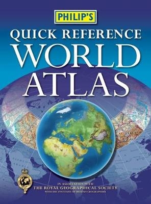
Philip's Quick Reference World Atlas
Seiten
2011
Philip's (Verlag)
978-1-84907-147-5 (ISBN)
Philip's (Verlag)
978-1-84907-147-5 (ISBN)
- Titel ist leider vergriffen;
keine Neuauflage - Artikel merken
Great value at GBP6.99 for home, school and college use. Physical map coloration makes it easy to visualize the Earth's terrain. Detailed street plans for 21 of the world's most important cities. Classic Philip's mapping - superb detail, excellent coverage, clearly displayed. Published in association with The Royal Geographical Society.
The new edition of Philip's Quick Reference World Atlas has been specially created from the latest digital cartography. The 48 pages of up-to-date maps are physically coloured to give a superb representation of the Earth's surface, with cities and towns, as well as major transport routes and administrative boundaries, clearly shown.A special feature of this atlas is the 6-page 'City Maps' section, including detailed city-centre maps of Amsterdam, Athens, Bangkok, Berlin, Brussels, Delhi, Dublin, Edinburgh, Lisbon, London, Madrid, Mexico City, Mumbai, New York, Paris, Prague, Rio de Janeiro, Rome, Singapore, Sydney and Tokyo, with streets and tourist sites clearly marked.At the end of the atlas, the 9-page letter-figure index lists all major towns and cities, plus geographical features such as mountains, rivers and lakes.The slim paperback format of this atlas makes it ideal for use in the office, at home or by students, at an affordable price.
The new edition of Philip's Quick Reference World Atlas has been specially created from the latest digital cartography. The 48 pages of up-to-date maps are physically coloured to give a superb representation of the Earth's surface, with cities and towns, as well as major transport routes and administrative boundaries, clearly shown.A special feature of this atlas is the 6-page 'City Maps' section, including detailed city-centre maps of Amsterdam, Athens, Bangkok, Berlin, Brussels, Delhi, Dublin, Edinburgh, Lisbon, London, Madrid, Mexico City, Mumbai, New York, Paris, Prague, Rio de Janeiro, Rome, Singapore, Sydney and Tokyo, with streets and tourist sites clearly marked.At the end of the atlas, the 9-page letter-figure index lists all major towns and cities, plus geographical features such as mountains, rivers and lakes.The slim paperback format of this atlas makes it ideal for use in the office, at home or by students, at an affordable price.
| Erscheint lt. Verlag | 4.1.2011 |
|---|---|
| Verlagsort | London |
| Sprache | englisch |
| Maße | 232 x 313 mm |
| Gewicht | 310 g |
| Themenwelt | Reisen ► Karten / Stadtpläne / Atlanten ► Welt / Arktis / Antarktis |
| ISBN-10 | 1-84907-147-0 / 1849071470 |
| ISBN-13 | 978-1-84907-147-5 / 9781849071475 |
| Zustand | Neuware |
| Haben Sie eine Frage zum Produkt? |
Mehr entdecken
aus dem Bereich
aus dem Bereich


