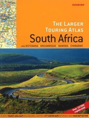
Larger Touring Atlas of South Africa
& Botswana, Mozambique, Namibia, Zimbabwe
Seiten
2009
|
3rd Revised edition
Sunbird Publishers Ltd (Verlag)
978-1-920289-17-1 (ISBN)
Sunbird Publishers Ltd (Verlag)
978-1-920289-17-1 (ISBN)
- Titel ist leider vergriffen;
keine Neuauflage - Artikel merken
A touring atlas covers Southern Africa - South Africa is broken down into a main map section covering the whole country, tourist areas, where the main touring areas are shown in larger scale and much greater detail, and city maps where all of the main city centres, and surrounding areas (where appropriate) are shown.
This touring atlas is designed for all road users from the regular commercial traveller to the casual tourist. It covers all of Southern Africa- South Africa is broken down into a main map section covering the whole country, tourist areas, where the main touring areas are shown in larger scale and much greater detail, and city maps where all of the main city centres, and surrounding areas (where appropriate) are shown in detail. The remaining countries in Southern Africa are handled in a similar way with a full spread for each country, together with main tourist areas and city plans. There is also a comprehensive index of place names, and where appropriate an index to city plans. The touring sections show places of interest in that locale e.g. map of KwaZulu Natal shows the battlefields, the Western Cape shows the wineries, and so on. Photographs of the scenic areas are dropped in where appropriate.
This touring atlas is designed for all road users from the regular commercial traveller to the casual tourist. It covers all of Southern Africa- South Africa is broken down into a main map section covering the whole country, tourist areas, where the main touring areas are shown in larger scale and much greater detail, and city maps where all of the main city centres, and surrounding areas (where appropriate) are shown in detail. The remaining countries in Southern Africa are handled in a similar way with a full spread for each country, together with main tourist areas and city plans. There is also a comprehensive index of place names, and where appropriate an index to city plans. The touring sections show places of interest in that locale e.g. map of KwaZulu Natal shows the battlefields, the Western Cape shows the wineries, and so on. Photographs of the scenic areas are dropped in where appropriate.
| Erscheint lt. Verlag | 1.11.2009 |
|---|---|
| Zusatzinfo | 20 colour photos & 100 colour maps |
| Verlagsort | Cape Town |
| Sprache | englisch |
| Maße | 390 x 300 mm |
| Gewicht | 226 g |
| Themenwelt | Reisen ► Karten / Stadtpläne / Atlanten ► Afrika |
| ISBN-10 | 1-920289-17-8 / 1920289178 |
| ISBN-13 | 978-1-920289-17-1 / 9781920289171 |
| Zustand | Neuware |
| Haben Sie eine Frage zum Produkt? |
Mehr entdecken
aus dem Bereich
aus dem Bereich
Entdeckungsreisen im Land der San: von Gaborone zur größten …
Buch | Softcover (2024)
DuMont Reiseverlag
CHF 37,90
