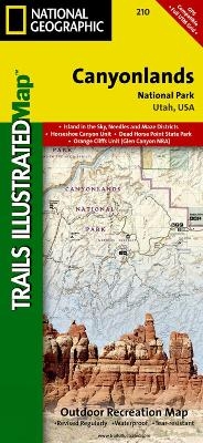
Canyonlands National Park
Trails Illustrated National Parks
Seiten
2012
|
2023rd Revised ed.
National Geographic Maps (Verlag)
978-1-56695-326-9 (ISBN)
National Geographic Maps (Verlag)
978-1-56695-326-9 (ISBN)
Included on this map are Canyonlands National Park, the Island in the Sky district, the Needles district, and the Maze district. The map also includes the Colorado River, the Green River, Indian Creek Wilderness, Bridger Jack Mesa Wilderness, Butler Wash Wilderness, Canyon Rims Recreation Area, and fascinating information about the park's archaeology. Ideal for recreation activities in this beautiful area, including hiking, biking, camping, climbing, photography - any back-country outdoor activity. Includes UTM grids for use with your GPS unit.
| Erscheint lt. Verlag | 2.8.2012 |
|---|---|
| Verlagsort | Evergreen |
| Sprache | englisch |
| Maße | 110 x 235 mm |
| Gewicht | 92 g |
| Einbandart | gefalzt |
| Themenwelt | Reisen ► Karten / Stadtpläne / Atlanten ► Nord- / Mittelamerika |
| ISBN-10 | 1-56695-326-X / 156695326X |
| ISBN-13 | 978-1-56695-326-9 / 9781566953269 |
| Zustand | Neuware |
| Haben Sie eine Frage zum Produkt? |
Mehr entdecken
aus dem Bereich
aus dem Bereich
Karte (gefalzt) (2024)
Freytag-Berndt und ARTARIA (Verlag)
CHF 18,95
Karte (gefalzt) (2023)
Reise Know-How (Verlag)
CHF 16,90
Karte (gefalzt) (2023)
Reise Know-How (Verlag)
CHF 16,90


