


Bali Travel Map Seventh Edition
2009
|
7th Revised edition
Periplus Editions (Verlag)
978-0-7946-0590-2 (ISBN)
Periplus Editions (Verlag)
978-0-7946-0590-2 (ISBN)
- Titel erscheint in neuer Auflage
- Artikel merken
Zu diesem Artikel existiert eine Nachauflage
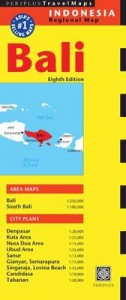
This specialist regional map covers Bali to a scale of 1:250,000. It also includes city plans of Denpasar, Kuta Area, Nusa Dua Area, Ubud Area, Sanur, Gianyar, Semara Pura, Singaraja, Lovina, Candidasa and Tabanan, all to varying scales.
This specialist regional map covers Bali to a scale of 1:250,000. It also includes city plans of Candidasa to 1:10,000, Nusa Dua Area, Sanur, Gianyar and Semara Pura all at 1;15,000, Tabanan and Denpasar at 1:20,000, and Kuta Area, Ubud Area, Singaraja and Lovina, are scaled at 1:25,000. The design of this map allows for one panel to be viewed at a time, for ease of use, and includes a comprehensive selection of tourist attractions.
This specialist regional map covers Bali to a scale of 1:250,000. It also includes city plans of Candidasa to 1:10,000, Nusa Dua Area, Sanur, Gianyar and Semara Pura all at 1;15,000, Tabanan and Denpasar at 1:20,000, and Kuta Area, Ubud Area, Singaraja and Lovina, are scaled at 1:25,000. The design of this map allows for one panel to be viewed at a time, for ease of use, and includes a comprehensive selection of tourist attractions.
| Erscheint lt. Verlag | 8.9.2011 |
|---|---|
| Reihe/Serie | Periplus Maps |
| Zusatzinfo | 2 Area Maps; 9 City Plans |
| Verlagsort | Boston |
| Sprache | englisch |
| Maße | 260 x 108 mm |
| Themenwelt | Reisen ► Karten / Stadtpläne / Atlanten ► Asien |
| ISBN-10 | 0-7946-0590-7 / 0794605907 |
| ISBN-13 | 978-0-7946-0590-2 / 9780794605902 |
| Zustand | Neuware |
| Informationen gemäß Produktsicherheitsverordnung (GPSR) | |
| Haben Sie eine Frage zum Produkt? |
Mehr entdecken
aus dem Bereich


aus dem Bereich
Karte (gefalzt) (2024)
Freytag-Berndt und ARTARIA (Verlag)
CHF 18,95
Karte (gefalzt) (2023)
Reise Know-How Peter Rump GmbH (Verlag)
CHF 14,90
Karte (gefalzt) (2024)
Reise Know-How Peter Rump GmbH (Verlag)
CHF 20,60