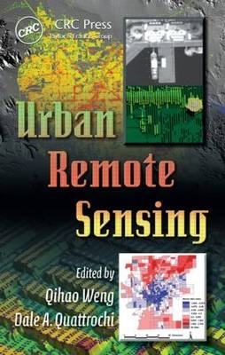
Urban Remote Sensing
Crc Press Inc (Verlag)
978-0-8493-9199-6 (ISBN)
- Titel erscheint in neuer Auflage
- Artikel merken
Driven by advances in technology and societal needs, the next frontier in remote sensing is urban areas. With the advent of high-resolution imagery and more capable techniques, the question has become "Now that we have the technology, how do we use it?" The need for a definitive resource that explores the technology of remote sensing and the issues it can resolve in an urban setting has never been more acute.
Containing contributions from world renowned experts, Urban Remote Sensing provides a review of basic concepts, methodologies, and case studies. Each chapter demonstrates how to apply up-to-date techniques to the problems identified and how to analyze research results.
Organized into five sections, this book:
Focuses on data, sensors, and systems considerations as well as algorithms for urban feature extraction
Analyzes urban landscapes in terms of composition and structure, especially using sub-pixel analysis techniques
Presents methods for monitoring, analyzing, and modeling urban growth
Illustrates various approaches to urban planning and socio-economic applications of urban remote sensing
Assesses the progress made to date, identifies the existing problems and challenges, and demonstrates new developments and trends in urban remote sensing
This book is ideal for upper division undergraduate and graduate students, however it can also serve as a reference for researchers or those individuals interested in the remote sensing of cities in academia, and governmental and commercial sectors. Urban Remote Sensing examines how to apply remote sensing technology to urban and suburban areas.
URBAN FEATURE EXTRACTION
True Orthoimage Generation for Urban Areas with Very High Buildings; Guoqing Zhou and John Kelmelis
Urban Terrain and Building Extraction from Airborne LIDAR Data;
Jie Shan and Aparajithan Sampath
Reconstruction of Buildings in SAR Imagery of Urban Areas; Uwe Stilla and Uwe Soergel
URBAN COMPOSITION AND STRUCTURE
Subpixel Analysis of Urban Landscapes; Qihao Weng and Dengsheng Lu
Bayesian Spectral Mixture Analysis for Urban Vegetation; Conghe Song
Urban Mapping with Geospatial Algorithms; Soe W. Myint
Applying Imaging Spectrometry in Urban Areas; Martin Herold Sebastian Schiefer, Patrick Hostert, and Dar A. Roberts
URBAN LAND DYNAMICS
Urban Land Use Prediction Model with Spatiotemporal Data Mining and GIS; Weiguo Liu, Karen C. Seto, Zhanli Sun, and Yong Tian
Assessing Urban Growth with Subpixel Impervious Surface Coverage; George Xian
Remote Sensing and Urban Growth Theory; Martin Herold, Jeff Hemphill, and Kenneth C. Clarke
URBAN PLANNING AND SOCIOECONOMIC APPLICATIONS
Urban Heat Island Identification and Climatologic Analysis in a Coastal, Tropical City: San Juan, Puerto Rico; Jorge E. González, Jeffrey C. Luvall, Douglas L. Rickman, Daniel Comarazamy, and Ana J. Picón
Assessing Urban Environmental Quality with Multiple Parameters; Janet Elizabeth Nichol and Man Sing Wong
Population Estimation and Interpolation Using Remote Sensing; Xiaohang Liu and Martin Herold
Sociodemographic Characterization of Urban Areas Using Nighttime Imagery, Google Earth, Landsat, and "Social" Ground Truthing; Paul C. Sutton, Matthew J. Taylor, Sharolyn Anderson, and Christopher D. Elvidge
Integration of Remote Sensing and Census Data for Assessing Urban Quality of Life: Model Development and Validation; Guiying Li and Qihao Weng
PROGRESS, PROBLEMS, AND PROSPECTS
Mapping Human Settlements Using the Middle Infrared
(3-5 µm): Advantages, Prospects, and Limitations; Geoffrey M. Henebry
New Developments and Trends for Urban Remote Sensing; Manfred Ehlers
Spectral Resolution in the Context of Very High Resolution Urban Remote Sensing; Paolo Gamba and Fabio Dell'Acqua
| Erscheint lt. Verlag | 27.10.2006 |
|---|---|
| Reihe/Serie | Remote Sensing Applications Series |
| Co-Autor | Jie Shan, Manfred Ehlers, Guoqing Zhou |
| Zusatzinfo | 90 equations; 70 Halftones, black and white; 33 Tables, black and white; 16 Illustrations, color; 241 Illustrations, black and white |
| Verlagsort | Bosa Roca |
| Sprache | englisch |
| Maße | 156 x 235 mm |
| Gewicht | 760 g |
| Themenwelt | Naturwissenschaften ► Geowissenschaften ► Geografie / Kartografie |
| Technik | |
| ISBN-10 | 0-8493-9199-7 / 0849391997 |
| ISBN-13 | 978-0-8493-9199-6 / 9780849391996 |
| Zustand | Neuware |
| Haben Sie eine Frage zum Produkt? |
aus dem Bereich


