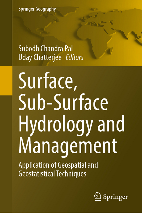
Surface, Sub-Surface Hydrology and Management
Springer International Publishing (Verlag)
978-3-031-62375-2 (ISBN)
- Noch nicht erschienen - erscheint am 07.03.2025
- Versandkostenfrei
- Auch auf Rechnung
- Artikel merken
This book explores the surface and subsurface hydrological conditions and their management in a tropical or sub-tropical setting applying geospatial and geostatistical derived predictive methods. The book is a research of the surface and subsurface hydrological processes as a result of over-exploitation for agricultural production and irrigation, which resulted in a significant drop in water even during pre-monsoon period and a charge up study to control surface and subsurface water scarcity. Recent and expected trends indicate that future water challenges will become more complex. Over-exploitation of groundwater and surface water scarcity are posing an increasing threat to food security and rural livelihood stability. Understanding the features of groundwater and surface water and how they interact with the environment, population, and social aspects is a difficult challenge for researchers, they must provide guidance for sustainable resource management while balancing economic efficiency and ecological health. This book stands out for its focus on using geospatial and geostatistical methods to tackle practical issues. The chapters demonstrate how advanced analytical tools can be used to extract useful insights from complex hydrological datasets, such as mapping surface water flow patterns and delineating groundwater contamination plumes. Additionally, including case studies from various geographic areas offers readers a worldwide view on hydrological challenges and approaches to managing them. This book acts as a catalyst for more research and dialogue in the areas of Environmental Sciences, Geography, Hydrology, Natural Hazards, Geospatial Sciences, Remote Sensing & GIS, Agriculture, Crop-Science, Forestry, Soil Science, Agronomy, Humanistic & Social Sciences, etc., promoting organization in the field of surface and sub-surface hydrology. We aim to advance scientific knowledge and promote sustainable water resource management by combining expertise from various disciplines and highlighting the potential of geospatial and geostatistical techniques.
Dr. Subodh Chandra Pal, Assistant Professor has been working in the Postgraduate Department of Geography, The University of Burdwan, Purba Bardhaman, West Bengal, India. He received his Ph.D. in Geography from Visva-Bharati (Central University in India) in 2015. His main fields of expertise are fluvial geomorphology, pedo-geomorphology, land degradation, soil erosion, gully erosion, landslide vulnerability, climate change, water resources monitoring and management and published more than hundreds international and national research articles in various renowned journals. His research work has been funded by the University Grants Commission (UGC), Govt. of India and Department of Science and Technology (DST), Govt. of India. Dr. Pal has served as a reviewer for many International reputed journals.
Dr. Uday Chatterjee is an Assistant Professor at the Department of Geography, Bhatter College, Dantan, Paschim Medinipur, West Bengal, India and an Applied Geographer with a Doctoral Degree in Applied Geography at Ravenshaw University, Cuttack, Odisha, India. His areas of research interest cover Urban Planning, Social and Human geography, Applied Geomorphology, Hazards & Disasters, Environmental Issues, disaster governance, community-based disaster risk management, climate change adaptation, urban risk management, and disaster. He has delivered 07 invited lectures in University Grants Commissions (UGC) sponsored national seminars and various academic departments of different colleges in India. In addition, he presented 18 papers in national and international seminars/conferences held in India as well as chaired and co-chaired more than 5 technical sessions. He has successfully guided project dissertations to undergraduate students. He has also conducted (Convener) one Faculty Development Programme on 'Modern methods of teaching and advanced research methods' sponsored by Indian Council of Social Science Research (ICSSR), Govt. of India. Currently, Dr. Uday Chatterjee has completed the Special Issue (S.I) of Urbanism, Smart Cities and Modelling, Geojournal, Springer as a Lead Editor, book series editor Development in Environmental Science, Elsevier. His research work has been funded by the West Bengal Pollution Control Board (WBPCB) Govt. of West Bengal, India. He has served as a reviewer for many International journals. Currently, Dr. Chatterjee doing the international project, in collaboration with Indonesia, Malaysia, and Japan funded by APN (Asia Pacific- Global Change Research) and he is the guest editor of the special issue Social Ecology, Human-Well-being and Sustainability, Global Social Welfare journal, Springer. He has published 30 research papers,10 edited books, and 2 author books, 11 book chapters, and 2 conference proceedings.
.- Assessment of basin hydrological phenomena using state of the art methods and in situ field measurements.
.- A Geographical appraisal of hydrological drought.
.- Technologies and approaches to support community flood Initiatives.
.- Assessing Flood Susceptibility using GIS and AHP method.
.- Assessing the seasonal dynamics of surface water resources using satellite based remote sensing.
.- Soil Moisture Evaluation in an Ungauged Basin in Southwest Nigeria.
.- Evaluation of Meandering Characteristics of the Jhelum River Using Geo Spatial Techniques.
.- Analysing the Relationship between Surface Water and Groundwater.
.- Assessment of Surface Water Quality Modelling for Drinking Purposes in Brahmani River Basin.
.- Unraveling the nexus between socioeconomic facets and land use and cover change for analyzing agricultural productivity within riverine ecosystems.
.- Geospatial Analysis of Flood and Drought Vulnerability in Rajshahi District.
.- Water Quality Assessment and Pollution Source Identification of a Semi Urban Water Body near to Waste Dumping Zone.
.- Estimation of morphometric and morphotectonic Indices of the Kanhan River Basin.
.- Waterlogging Susceptibility Zone Assessment in Kolkata by the Flow Accumulation Method.
.- Vulnerability of Reservoir to Sequestrated Solutes from Feeder Streams: A Case Study of Opa in Southwestern Nigeria.
.- Soil erosion risk and vulnerable zone identification using remote sensing and GIS techniques.
.- Performance Evaluation of a Reservoir during Flooding.
.- Applications of Water Quality Index (WQI) and geostatistical methods for long term assessment of Mountain Lake.
.- Assessment of Soil Erosion Dynamics and Flood Zonation using integrated RS & GIS based RUSLE Model for Prioritization of Sub Watersheds Morphometry.
.- Geo spatial modelling of potential soil erosion estimation for better conservation planning.
.- Digital Terrain Analysis for Characterization of Terrain Variables Governing Soil Erosion and Watershed Hydrology.
.- Climate change impact on flood frequencies using geospatial modelling.
.- Surface and sub-surface hydrological management.
GIS based modeling for water resource monitoring and management.
,- Enhancing watershed management through advanced geospatial and morphometric approaches for Wainganga river basin, central India.
.- Modelling and mapping of natural resource management using RS & GIS.
.- Evaluation of Surface Water Quality in Mahanadi River Basin, Odisha, for Drinking Purposes Based on GIS, MEREC and a Hybrid MACROS Approach.
.- Evaluation of Surface Water Quality in Mahanadi River Basin, Odisha, for Drinking Purposes Based on GIS, MEREC and a Hybrid MACROS Approach.
.- Assessment of Water Risk and Feasibility of Rooftop Rainwater Harvesting.
.- Integrating RS and GIS Techniques for Enhanced Natural Resource Management.
| Erscheinungsdatum | 03.11.2024 |
|---|---|
| Reihe/Serie | Springer Geography |
| Zusatzinfo | XXVI, 832 p. 248 illus., 224 illus. in color. |
| Verlagsort | Cham |
| Sprache | englisch |
| Maße | 155 x 235 mm |
| Themenwelt | Naturwissenschaften ► Biologie ► Ökologie / Naturschutz |
| Naturwissenschaften ► Geowissenschaften ► Geografie / Kartografie | |
| Naturwissenschaften ► Geowissenschaften ► Hydrologie / Ozeanografie | |
| Schlagworte | Geospatial Modelling • Hydrology • Subsurface water • Surface Water • Water Hazards |
| ISBN-10 | 3-031-62375-4 / 3031623754 |
| ISBN-13 | 978-3-031-62375-2 / 9783031623752 |
| Zustand | Neuware |
| Informationen gemäß Produktsicherheitsverordnung (GPSR) | |
| Haben Sie eine Frage zum Produkt? |
aus dem Bereich


